


Page 5-14 500 SERIES INSTALLATION MANUAL
Rev G P/N 190-00181-02
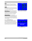
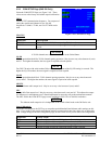
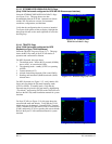
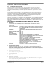
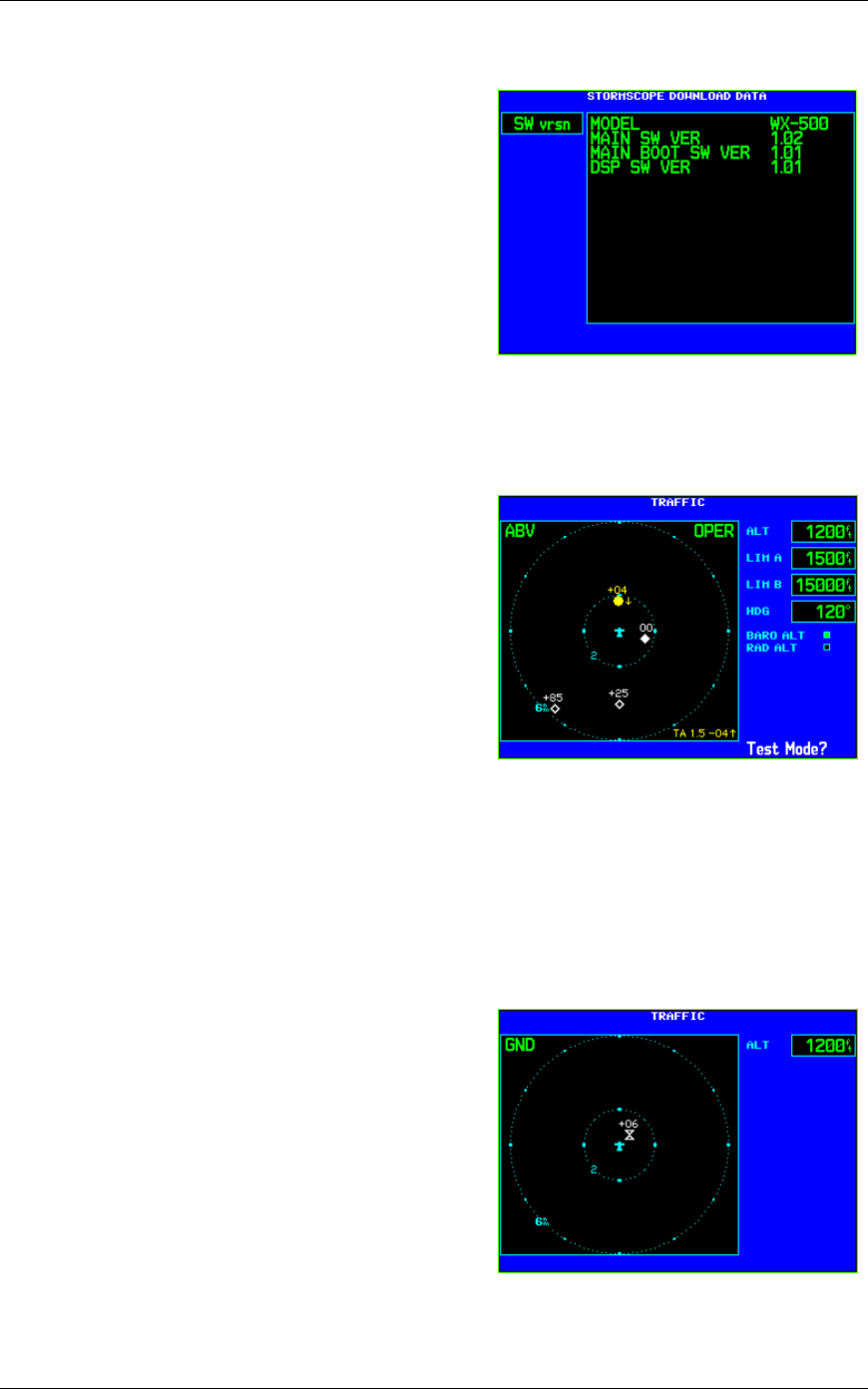
5.2.15 STORMSCOPE DOWNLOAD DATA Page
(Only if 500 Series unit configured for BFG WX-500 Stormscope interface)
Select the STORMSCOPE DOWNLOAD DATA Page
(see Figure 5-16). This page shows raw data
downloadable from the WX-500. Optional sets of data
include WX-500 software version, environmental
conditions, configuration, and fault data.
Verify that the configuration data is correct as intended.
To request which packet of data to display, highlight the
data group title and use the small right knob to select the
desired group.
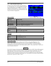
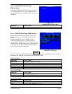
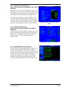
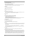
5.2.16 TRAFFIC Page
(Only if 500 Series unit configured for BFG
Skywatch or Ryan TCAD interfaces)
Select the TRAFFIC Page (see Figure 5-17). This page
shows the BFG Skywatch or Ryan TCAD modes of
operation and current traffic situation.
For BFG Skywatch, this page shows:
1. The altitude mode—below (BLW), normal (NORM),
above (ABV), or unrestricted (UNR)
2. The operating mode—standby (STBY) or operating
(OPER)
3. Current altitude (ALT)
4. Altitude limits being imposed (LIM A and LIM B)
5. Heading, and barometric (BARO) and radio (RAD)
altitude status.
For BFG Skywatch (see Figure 5-17), verify that the 500
Series unit can change the Skywatch operating mode
(STBY or OPER). In standby mode, verify that the
Skywatch may be placed in self-test mode by highlighting
“Test Mode?” and pressing ENTER on the 500 Series unit.
Refer to the BFG Skywatch installation manual for system
checkout.
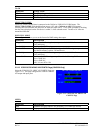
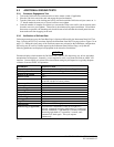
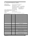
For Ryan TCAD (see Figure 5-18), this page shows the
current shield mode and altitude. Verify that the TCAD
shield mode may be changed—Ground (GND), Terminal
(TML), Standard (STD), En Route (ENR), or Unrestricted
(UNR), and that the TCAD is reporting the correct altitude.
Refer to the Ryan TCAD installation manual for system
checkout.
Figure 5-16. STORMSCOPE
DOWNLOAD DATA Page
Figure 5-17. TRAFFIC Page (Skywatch)
Figure 5-18. TRAFFIC Page (TCAD)