


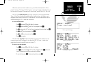


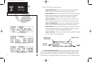
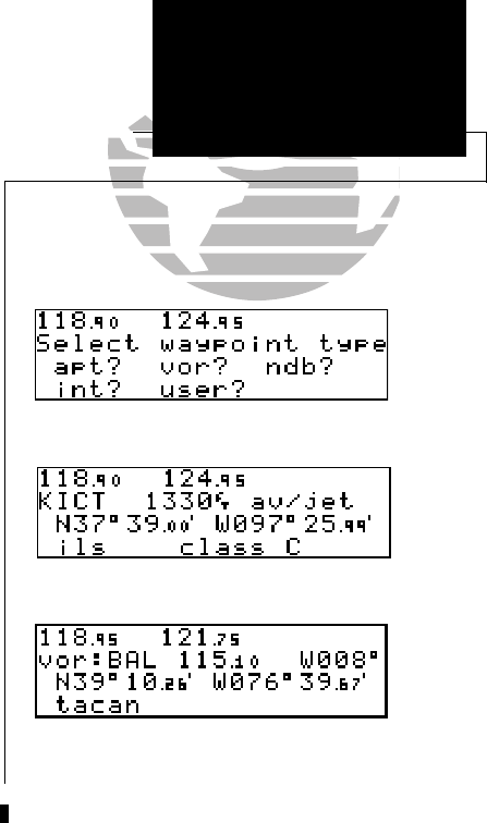
The GNC 300 organizes waypoints into one of five waypoint categories for your con-
venience. Each waypoint category provides different types of detailed information for a
selected facility:
• Airports - Identifier, city/state, country, facility name, position (lat/lon),
elevation, fuel services and communications frequencies.
• VORs - Identifier, city/state, country, facility name, position (lat/lon),
frequency, magnetic variation, co-located DME or TACAN and weather
broadcast indication.
• NDBs - Identifier, city/state, country, facility name, position (lat/lon),
frequency and weather broadcast indication.
• Intersections - Identifier, country, position (lat/lon), nearest VOR.
• User - Identifier (name), position (lat/lon), reference waypoint.
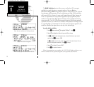
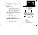
To view the waypoint information for a desired waypoint, select the waypoint
category from the waypoint menu page.
To choose a waypoint category (for viewing information):
1. Press
W
and rotate
O
to display the waypoint menu page.
2. Press
C
twice and rotate
O
to highlight the desired waypoint category.
3. Press
E
to accept the waypoint category. The waypoint identification or position page for
the selected category will appear with the waypoint identifier field ready for entry.
33
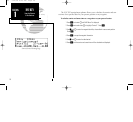
REFERENCE
Airport
Communication
SECTION
3
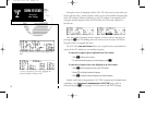
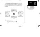
WPT KEY
Waypoint Categories
& Menu Page
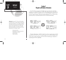
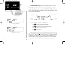
Airport Position Page
VOR Position Page
Waypoint Menu Page
300 7/14/98 8:49 AM Page 33