


The GNC 300 NavData
®
card contains over 100 map datums for you to use when
navigating. By default, your unit calculates positions using the WGS-84 map datum.
If you are using charts based on another datum, you must set the GNC 300 to use
the same datum. Using a map datum that does not match the sectionals you are using
can result in significant differences in position information. If you are using maps for
reference only, the GNC 300 will provide correct navigation guidance to the way-
points contained in the database, regardless of the datum selected.
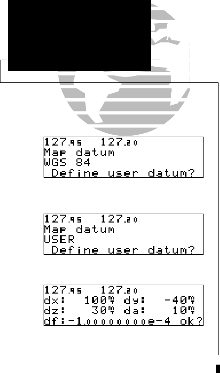
To change the map datum to one listed in Appendix F:
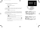
1. Press and hold
M
, and use
O
to display the map datum page.
2. Press
C
twice.
3. Use
O
to highlight the current map datum.
4. Use
K
to change the datum.
5. Press
C
to complete.
To create a user datum:
1. Press and hold
M
, and use
O
to display the map datum page.
2, Press
C
twice.
3. Use
O
to highlight ‘Define user datum?’. Press
E
.
4. Enter the five parameters of the map datum using
K
and
O
. Press
E
to accept a
field. The signs of each value (+/-) should follow the convention: WGS84-local geodetic
system.
5. Use
O
to highlight ‘ok?’, and press
E
.
6. To activate the user datum, select ‘USER’ on the map datum page as described above.
102
Getting Started
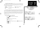
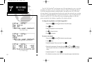
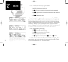
Status & Position
Map Datum Page with ‘USER’ selected.
Map Datum Page
User Datum Page
SECTION
7
UNIT SETTINGS
Map Datums
300 7/14/98 8:51 AM Page 102