


4-52
Garmin G600 Pilot’s Guide
190-00601-02 Rev. B
Foreword
Sec 1
System
Sec 2
PFD
Sec 3
MFD
Sec 4
Hazard
Avoidance
Sec 5
Additional
Features
Sec 6
Annun.
& Alerts
Sec 7
Symbols
Sec 8
GlossaryAppendix A
Appendix B
Index
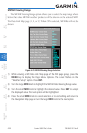
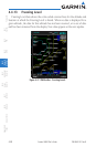
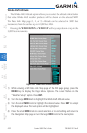
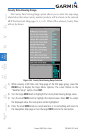
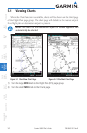
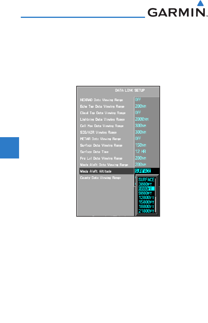
Winds Aloft Altitude
The Winds Aloft Altitude option allows you to select the altitude where below
that value Winds Aloft weather products will be shown on the selected MFD
Wx Data Link Map page (1, 2, or 3). Altitude can be selected in 3000 foot
increments from the surface up to 42,000 feet MSL.
Pressing the WIND DOWN or WIND UP soft keys steps down or up in the
3,000 foot increments.
Figure 4-42 Winds Aloft Altitude Selection
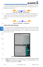
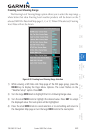
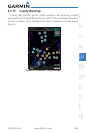
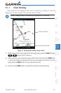
1) While viewing a WX Data Link Map page of the WX page group, press the
MENU key to display the Page
Menu Options
. The cursor flashes on the
“Weather Setup” option. Press ENT
.
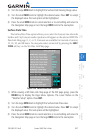
2) Turn the large MFD knob to highlight the Winds Aloft Altitude value.
3) Turn the small MFD knob to highlight the desired value. Press ENT
to accept
the displayed value. The next option will be highlighted.
4) Press the small MFD knob to cancel selection or to end editing and return to
the Navigation Map page or turn the large MFD knob to the next option.