


4-7190-00601-02 Rev. B
Garmin G600 Pilot’s Guide
Foreword
Sec 1
System
Sec 2
PFD
Sec 3
MFD
Sec 4
Hazard
Avoidance
Sec 5
Additional
Features
Sec 6
Annun.
& Alerts
Sec 7
Symbols
Sec 8
Glossary Appendix A
Appendix B
Index
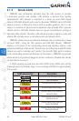
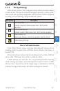
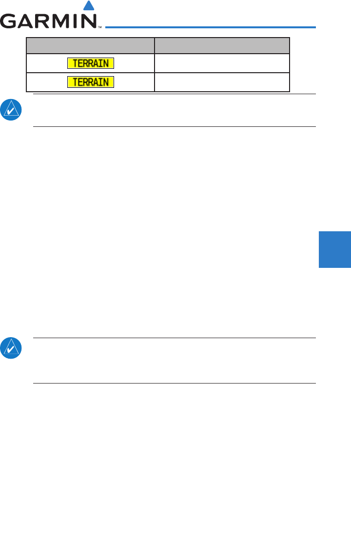
TAWS Annunciation Description
Premature Descent Alert Caution
Negative Climb Rate Caution
NOTE: TAWS Caution Alerts are displayed as black text on a yellow background; TAWS
Warning Alerts are displayed as white text on a red background.
4.1.3 Limitations
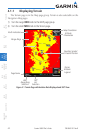
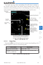
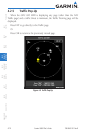
TERRAIN displays terrain and obstructions relative to the altitude of the
aircraft. The displayed alerts are advisory in nature only. Individual obstructions
may be shown if available in the database. However, all obstructions may not be
available in the database and data may be inaccurate. Never use this information
for navigation or to maneuver to avoid obstacles.
Terrain information is based on terrain elevation information in a database
that may contain inaccuracies. Terrain information should be used as an aid
to situational awareness. Never use it for navigation or to maneuver to avoid
terrain.
TERRAIN uses terrain and obstacle information supplied by government
sources. The displayed information should never be understood as being all-
inclusive.
NOTE: The data contained in the TERRAIN databases comes from
government agencies. Garmin accurately processes and cross-validates the
data but cannot guarantee the accuracy and completeness of the data.
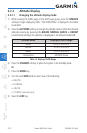
4.1.4 System Status
The TERRAIN system continually monitors several system-critical items,
such as database validity, hardware status, and GPS status. Should the system
detect a failure, a message is annunciated “TERRAIN has failed.”