


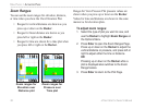
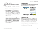
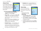
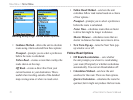

The Highway graphic
provides visual guidance,
taking you point by point to
your final destination. Your
course is represented by a
center line down the middle
of the graphic. As you move
toward each point on your
route, the graphic shows the
direction you should move to stay on course to the
next point. Use the In or Out keys to change the five
scale settings for zooming in or out on the highway.
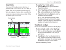
To
navigate using the Highway Page:
1. While navigating, use the Main Menu to
access the Highway Page icon, and press
Enter to observe your path of travel displayed
on the highway graphic.
2. Press Menu to display the Options Menu. You
can do the following: stop navigation, configure
data fields from four to three with a destination
guidance message, change the data fields, or
restore defaults to factory settings.
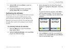
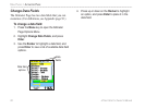
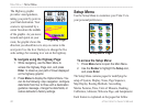
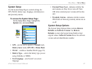
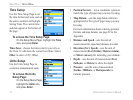
Setup Menu
Use the Setup Menu to customize your Vista Cx to
your personal preferences.
To access the Setup Menu:
1. Press Menu twice to open the Main Menu.
2. Use the Rocker to highlight the Setup icon,
and press Enter.
The Setup Menu contains pages for modifying the
setup of System, Display, Tones, Page Sequence,
Map Display, Routing Methods, Geocaching,
Marine Features, Time, Units of Measure, Heading,
Calibration, Altimeter, Welcome Page, and Jumpmaster.
Each feature is explained on the pages that follow.
Highway Page
Setup Menu Page
66 eTrex Vista Cx Owner’s Manual
MAIN MENU > SETUP MENU