


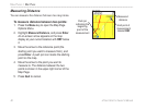

• Lock On Road—locks the map pointer to
display on the nearest road, compensating for
variances in map position accuracy.
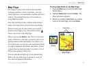
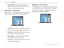
Map Setup – Tracks Page
The Map Setup – Tracks Page contains settings for Saved
Tracks, Track Log, Track Points, and the Go To Line.
Map Setup – Tracks Page
• Saved Tracks—sets the maximum zoom range
at which saved tracks are shown on the map.
• Track Log
—sets the maximum zoom range at
which active track logs are shown.
• Track Points
—sets the maximum number of
track points used to record a track.
• Go To Line
—selects either a bearing or course
line for navigating a track.
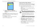
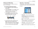
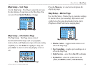
Map Setup – Points Page
Us the Map Setup – Points Page to set the map scale
at which Map Points, User Waypoints, Street Label,
and Land Cover appear on the Map Page. Select
Auto, Off, or from 20 ft to 800 mi.
Map Setup – Points Page
44 eTrex Vista Cx Owner’s Manual
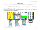
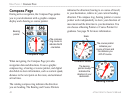
MAIN PAGES > MAP PAGE