


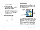

Data Field Definitions
The following list provides a brief definition of each
data field option.
Accuracy Of GPS—the current accuracy of your GPS-
determined location.
Ambient Pressure—the uncalibrated current pressure.
Ascent - Average—the average vertical distance of ascents.
Ascent - Maximum—the maximum ascent rate in feet per
minute.
Ascent - Total—the total distance ascended.
Barometer—the calibrated current pressure.
Bearing—the compass direction from your current position
to a destination point.
Course—
the desired path of travel from your starting point to
your destination point.
Descent - Average—the average vertical distance of descent.
Descent - Maximum—the maximum descent rate in feet
per minute.
Descent - Total—the total distance descended.
Distance - To Next—the distance to the next point on a route.
Distance - To Destination—the entire distance, from
beginning to end, of a route.
ETA - At Next—the estimated time that you will arrive at
the next point on your route, if you maintain your current
speed and course.
ETA - At Destination—the estimated time that you will
arrive at your destination, if you maintain your current
speed and course.
Elevation—the distance above or below mean sea level.
Elevation - Maximum—The highest elevation reached.
Elevation - Minimum—the lowest elevation reached.
Glide Ratio—the ratio of horizontal distance traveled to
vertical distance.
Glide Ratio To Dest—the glide ratio required to descend
from your position and elevation to the destination’s elevation.
Heading—your direction of travel as indicated by a
compass, in degrees or cardinal letters (N, S, E, W).
Location (lat/lon)—your current location as latitude and
longitude coordinates.
Location (selected)—your current location described in the
selected units of measure (other than latitude and longitude).
90 eTrex Vista Cx Owner’s Manual
APPENDIX > DATA FIELD DEFINITIONS