


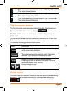

Page 93
How Do I Use It?
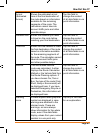
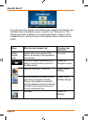
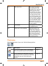
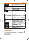
n/a Sky view circle The virtual sky shows
the visible part of the
sky above you, with your
position as the centre.
The satellites are shown
at their current positions.
The GPS receives data
from both the green and
yellow satellites. Signals
from the yellow satellites
are only received, while
green ones are used by
the GPS to calculate your
current location.
n/a Coordinates Your current GPS position
in WGS84 format.
n/a Status bar for the satellites Dark bars are for the
yellow and lit bars are
for the green satellites.
The more satellites your
GPS tracks (the green
ones), the better is your
calculated position.
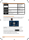
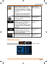
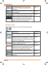
Find menu
Select the destination of your route. Tap the following buttons:
, .
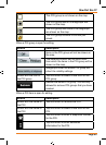
Button Description Reference
If you know at least a part of the address,
thisisthequickestwaytondthelocation.
Page 47
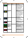
You can select your destination from the
thousands of POIs included with TRAX436
or from the ones you have previously
created.
Page 58