


Page 79
How Do I Use It?
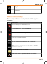
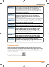
Symbol Name Description
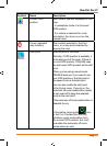
Current GPS
position
Your current position displayed on the
map.
•Inpedestrianmodeitistheexact
GPS position.
•Ifavehicleisselectedforroute
calculation, the arrow is put on the
nearest road.
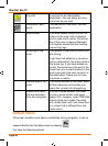
Cursor (selected
map location)
The location selected in the Find
menu, or a map point selected by
tapping the map.
Start point Therstpointoftheroute.
Normally, if GPS position is available, it
is the start point of the route. If there is
no valid GPS position, TRAX436 uses
the last known GPS position as the start
point.
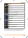
When you are using a saved route,
TRAX436 asks you if you want to use
yourGPSpositionortherstpointin
the saved route as the start point.
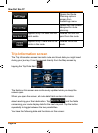
You can also modify the start point
in the Cursor menu. If you do so, the
automatic off-route recalculation needs
to be turned off to keep the selected
point as the start point.
If the automatic off-route recalculation is
disabled for any
of the above, tapping the
icon
intheTurnPrevieweldnotonly
initiates a route recalculation from
the current GPS position, but it will
re-enable the automatic off-route
recalculation as well.