


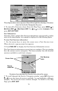
75
the destination, the unit automatically begins zooming in — one zoom
range at a time — always keeping the destination on the screen.
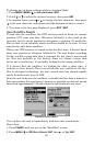
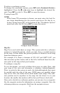
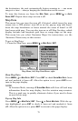
To turn this feature on, from the
MAP PAGE, press MENU|↓ to AUTO
ZOOM|ENT. Repeat these steps to turn it off.
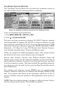
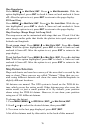
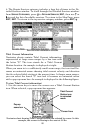
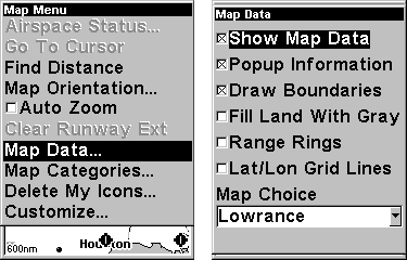
Map Data
This menu lets you turn the map off, if desired, which turns the map
screen into a GPS plotter; turn off or on the pop-up map info boxes;
draw the map boundaries or boxes around the areas of detail; or fill
land areas with gray. You can also turn on or off Map Overlays, which
display latitude and longitude grid lines or range rings on the map.
This menu lets you select Navionics Maps; for instructions, see the
Navionics Charts entry in this section.
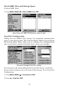
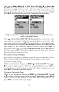
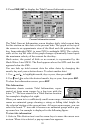
To get to Map Data:
1. From the Map Page, press
MENU|↓ to MAP DATA|ENT.
Map Menu, left, Map Data Menu, right.
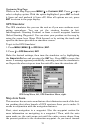
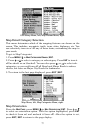
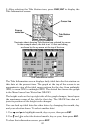
Show Map Data
Press
MENU|↓ to MAP DATA|ENT. Press ENT to check SHOW MAP DATA (turn
on) and uncheck it (turn off). After the option is set, press
EXIT to re-
turn to the page display.
NOTE:
In Aviation Mode, turning off
SHOW MAP DATA will clear all land map
information from the map display, but the aviation map remains.
This is a good way to quickly eliminate clutter if you need to focus
on just the air map.
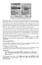
Pop-up Map Info
Press
MENU|↓ to MAP DATA|ENT. Press ↓ to POPUP MAP INFO. With the op-
tion highlighted, press
ENT to check it (turn on) and uncheck it (turn
off). After the option is set, press
EXIT to return to the page display.