


8
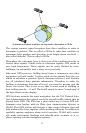
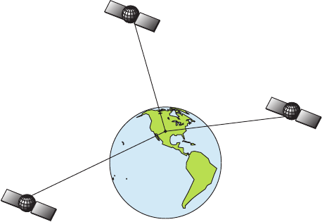
A minimum of three satellites are required to determine a 2D fix.
The system requires signal reception from three satellites in order to
determine a position. This is called a 2D fix. It takes four satellites to
determine both position and elevation (your height above sea level —
also called altitude). This is called a 3D fix.
Remember, the unit must have a clear view of the satellites in order to
receive their signals. Unlike radio or television signals, GPS works at
very high frequencies. These signals can be easily blocked by trees,
buildings, an automobile roof, a wing, even your body.
Like most GPS receivers, AirMap doesn’t have a compass or any other
navigation aid built inside. It relies solely on the signals from the sat-
ellites to calculate a position. Speed, direction of travel, and distance
are all calculated from position information. Therefore, in order for
AirMap to determine direction of travel, you must be moving and the
faster, the better. This is not to say that it won’t work at walking or
boat trolling speeds — it will. There will simply be more "wandering" of
the data shown on the display.
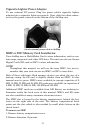
GPS is plenty accurate for route navigation, but the U.S. Federal Avia-
tion Administration has special needs for aircraft traffic control that go
beyond basic GPS. The FAA has a plan under way to boost GPS per-
formance even further with its Wide Area Augmentation System, or
WAAS. This GPS add-on will include a time control element that will
help airliners fly closer together while avoiding collisions. In addition to
carefully spacing airplanes along travel corridors, WAAS will eventu-
ally make instrument landings and takeoffs more accurate as it re-
places existing aviation navigation systems.