


27
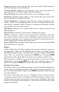
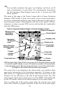
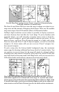
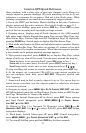
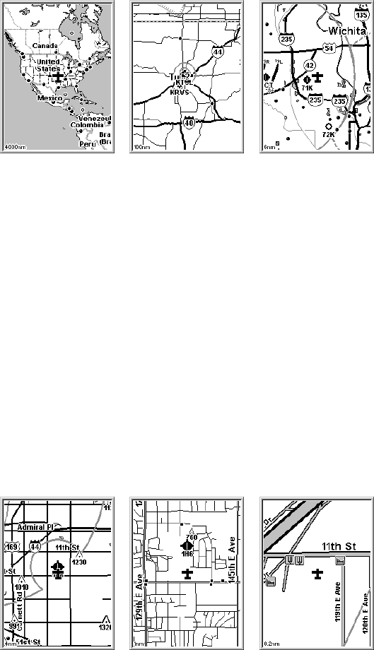
Far left, Map Page opening screen. Center, zoomed to 100 nautical miles
and right, zoomed to 6 nautical miles.
The Zoom In and Zoom Out keys zoom the map to enlarge or reduce its cov-
erage area and the amount of mapping detail shown. There are 39 available
map zoom ranges, from 0.02 nautical miles to 4,000 nautical miles.
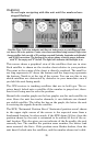
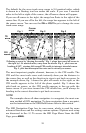
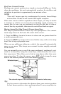
AirMap's high resolution screen makes it possible to display aeronauti-
cal chart features that look like the "real thing." If you're familiar with
sectional charts, you will instantly recognize items such as obstacles,
VORs, special airspaces, paved and unpaved airports and more. As you
zoom in closer, you'll see Class B airports appear at a fairly wide zoom.
Zoom in closer and Class C and D airports appear, as well as restricted
airspaces. At closer zooms still you can even see Class C airspace bor-
ders around airports.
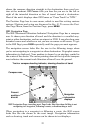
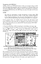
If you're using only the factory-loaded background map, the maximum
zoom range for showing additional land map detail is 6 nautical miles. You
can continue to zoom in closer, but the map will simply be enlarged without
revealing more map content (except for a few major city streets.) Load your
own high-detail custom map made with MapCreate, and you can zoom in to
0.02 nautical miles with massive amounts of accurate map detail.
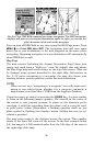
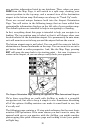
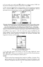
Map Pages with high-detail map of an urban area loaded on the MMC. At left, ar-
terial streets appear at the 4 nautical mile zoom range. At 1 nautical mile, minor
streets appear, along with square dots representing Points of Interest. Right, at the
0.4 nautical mile zoom, you can see an interstate highway with an exit, major and
minor streets as well as Point of Interest icons for two hotels and two restaurants.