


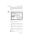
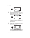

Moving
Map
Screen
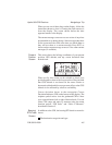
This moving map screenissimilartotheonejustdescribed,
but it fills the entire display.
The following information shows in highlighted boxes at
each corner of the display:
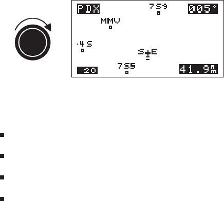
The destination waypoint
Bearing to the destination waypoint
Map scale
Range to the destination waypoint
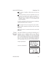
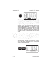
The moving map screens represent graphic views of your
navigation progress in a format easy to interpret while
flying. Note that the display orientation may be changed
so that the top of the may be north, desired track, or track.
The map setup option,described in Section 5, explains how
to change the orientation.
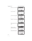
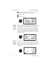
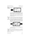
Zooming
In or Out
The moving map screens feature a handy zoom function to
allow you to enhance your view of navigation progress.
Zoom in or out by turning the SMALL knob. Zooming in
changes the view to enlarge map detail, as if the airplane
symbol was flying at a lower altitude over the mapsurface.
Similarly, zooming out allows a view of greater distance
around the airplane symbol, as if the airplane was flying
higher over the map. As you zoom in or out, the map scale
changes to show the new distance represented between the
airplane symbol andthe topborder ofthe display.Zooming
in close to airport waypoints enables you to see your
orientation in relation to available runways.
Navigating a Trip Apollo 360 GPS Receiver
4-8 P/N 560-0123-01