


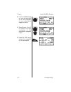
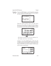
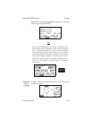
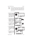
The bearing/range/ground speed screen shows your
selected ground speed and estimated time enroute on the
trip.
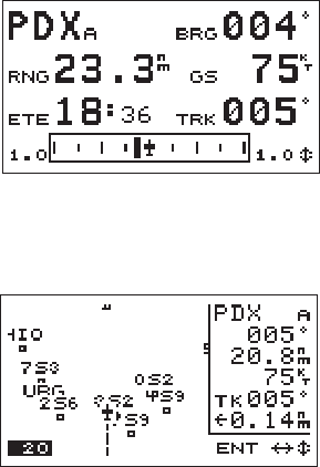
Check the moving map screens to view your navigation
progress.
Looking
Around
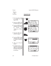
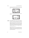
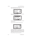
Turn the SMALL knob to zoom in and out and see
waypoints around you. The map scale shows in the lower
left corner of the display and indicates the represented
distance between the airplane symbol and the top of the
display. For example, if you are 20 nm from your
destination and the map scale is set to 20 nm, you should
be able to see the destination on the display. If, at the same
map scale setting, your destination was 30 nm distant, you
would not be able to see it on the display unless you
selected a larger map scale.
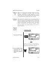
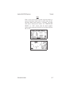
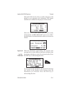
Change the map scale to “AUTO” to enable the auto zoom
feature. Auto zoom shows your destination on the screen
and keeps it in view as you navigate your course. The map
scale changes automatically to a smaller scale as you
approach the destination.
Tutorial Apollo 360 GPS Receiver
C-6 P/N 560-0123-01