


Section 1
Introduction to GPS Navigation
GPS
Overview
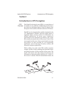
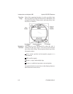
The Global Positioning System (GPS) is a constellation of
24 satellites in six orbit lanes 10,898 nautical miles above
the earth at an inclination angle of about 55 degrees from
the equator. Each satellite orbits the earthtwicein24hours.
The GPS was developed and the satellites launched by the
U.S. Department of Defense with the original intent of
supplying highly accurate position fix information for
military applications. In recent years, commercial
applications for the information provided by this system
have steadily increased in the civilian sector. Some of the
more popular civilian uses of the system include surveying
and position fix data recording for civil engineering
applications, and a broad range of marine, aviation, and
terrestrial navigation applications.
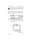
While orbiting the earth, each GPS satellite transmits
complex streams of data containing the operational status
and orbital location of all the satellites in the system. The
Apollo 360 receives this data stream and processes the
information to determine which satellites are “visible” to
the receiver’s antenna. With this determination made, the
Apollo 360 GPS Receiver Introduction to GPS Navigation
P/N 560-0123-01 1-1