


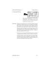
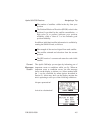
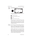

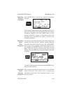

Using the moving map screen, you can easily track your
navigation progress as the aircraft travels over or near
waypoints beneath you. The moving map/nav window
screen shows this information in the box at the right side
of the display:
The destination waypoint and type
Bearing to the destination waypoint
Range to the destination waypoint
Ground speed
Current track
Course deviation distance and a directional arrow
indicating the direction to turn to get on course
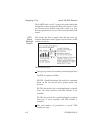
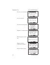
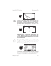
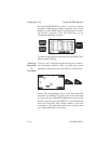
The map scale shows in the highlight at the lower left
corner of the screen. The scale shows the approximate
distance represented on the map between the airplane
symbol and the top border of the display. You can select
distance units of measure for the map scale and all other
navigation screens using the menu function “Display
Units” option explained in Section 5.
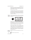
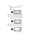
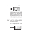
The figure below shows a change in scale caused by
turning the SMALL knob. The scale may be changed from
.1 nm to 750 nm or set to auto. In this case, the distance
from the airplane icon to the top of the screen is 20 miles.
Apollo 360 GPS Receiver Navigating a Trip
P/N 560-0123-01 4-7