


B-4
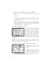
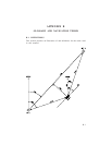
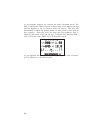
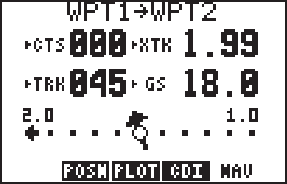
As an example, suppose you activate the route illustrated above. The
GPS 75 chooses the closest leg with a desired track of 45 degrees but your
position happens to be two nautical miles off course. The unit will
automatically compute the optimal course to steer (which is due north in
this example). Press the NAV key until the Nav Summary Page is
displayed, then select “CTS” on line two. Using the CTS direction (000°),
turn so that the track (TRK) and CTS direction match.
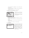
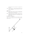
As you approach the course, CTS will slowly change and, once on course,
will be identical to the desired track.