5-3
· Enter the bearing and distance from the existing waypoint to the
new waypoint.
· Press ENT. A latitude and longitude location for the new waypoint
should now be displayed.
5.4WAYPOINT SCANNING
Throughout this manual, each time we have encountered a waypoint
name field, we have entered the waypoint name with the alphanumeric
keys. An alternative is to use the waypoint scanning feature.
To Scan for a Waypoint...
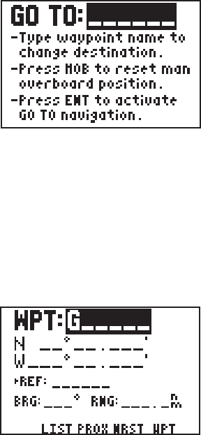
· As an example, use the GOTO
waypoint field. Press GOTO.
· The waypoint name field is
highlighted and may be blank or
may already show a GOTO
destination. If the waypoint name
field is not blank, press CLR.
· Press WPT. A waypoint name is now displayed.
· Scan for the desired waypoint with the arrow keys. (NOTE: As you
are scanning, up to nine nearest waypoints will be shown first;
followed by the entire list in numeric and alphabetical order.)
To limit the scanning range, you may specify the first letter(s) or
number(s) of the waypoint name.
To Perform a Limited Scan...
· For this example, select the
Waypoint Definition Page with
WPT and the WPT softkey, if
needed.
· Highlight the waypoint name field
with the arrow keys.
· If this field is not blank, press
CLR.
· Enter the first character of the waypoint name. For this example,
enter the letter “G”.
· Press WPT. Use the arrow keys to scan through all waypoints that
begin with the letter “G”.
