


75
UTM's are marked on USGS topographic charts. This system divides
the Earth into 60 zones, each 6 degrees wide in longitude. British,
Irish, Finnish, German, New Zealand, Swedish, Swiss, Taiwan, and
Greek grid systems are the national coordinate system used only in
their respective countries. In order to use these grid systems, you must
be in the respective country. This unit will pick the matching datum for
you when you select the grid. See the entry on Map Datum Selection for
more information.
The Military Grid Reference System (MGRS) uses two grid lettering
schemes, which are referred to as standard and standard + 10 MGRS
on this unit. Your position and datum in use determines which one to
use. If you use standard, and your position is off significantly, then try
the alternate. When the position format is changed, it affects the way
all positions are shown on all screens. This includes waypoints.
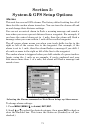
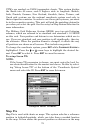
To change the coordinate system, press
ENT while COORDINATE SYSTEM is
highlighted. Press the ↑ or ↓ arrow keys to highlight the desired for-
mat. Press
ENT to select it. Press EXIT to erase the menus.
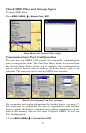
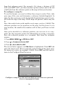
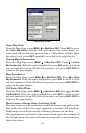
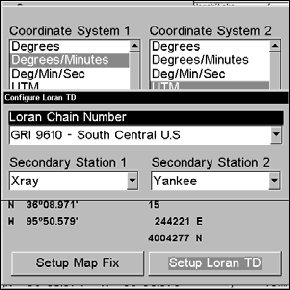
To setup Loran TD:
NOTE:
If the Loran TD conversion is chosen, you must enter the local Lo-
ran chain identification for the master and slaves. Do this by select-
ing "Setup Loran TD" at the bottom of the "Coordinate System"
menu and select the ID. Press
EXIT to erase this menu.
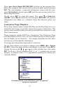
Configure Loran TD menu.
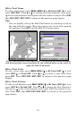
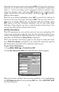
Map Fix
Map Fix is used with charts or maps. This system asks for a reference
position in latitude/longitude, which you take from a marked location
on the map. It then shows the present position as distance on the map