


Garmin G1000 Cockpit Reference Guide for the DA40/40F
10-5
SECTION 10 – HAZARD
AVOIDANCE
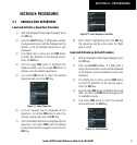
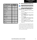
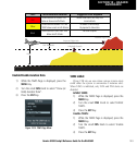
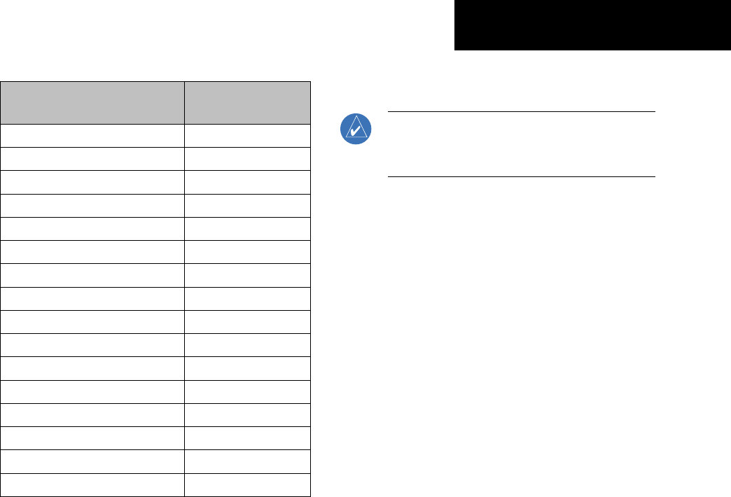
Weather Product Expires After
(minutes)
SIGMETs/AIRMETs 60
City Forecasts
60
County Warnings
60
Cyclone Warnings
60
Echo Tops
30
Freezing Levels
60
METARs
90
Lightning 30
NEXRAD 30
Radar Coverage
30
Cell Movement 30
Surface Analysis
60
TFRs 60
Winds Aloft
60
TAFs
60
Clouds Tops
60
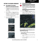
10.3 TRAFFIC INFORMATION SERVICE (TIS)
NOTE: Traffic Information Service (TIS) is only
available when the aircraft is within the service
volume of a TIS capable terminal radar site.
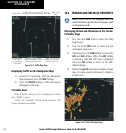
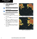
Displaying Traffic on the Traffic Map Page
1) Turn the large
FMS
Knob to select the Map
Page Group.
2) Turn the small
FMS
Knob to select the second
rectangular page icon.
3) Press the
OPERATE
Softkey to begin displaying
traffic. ‘TIS OPERATIING’ is displayed in the
Traffic Mode field.
4) Press the
STANDBY
Softkey to place the system
in the Standby mode. ‘TIS STANDBY’ will be
displayed in the Traffic Mode field.
5) Rotate the
Joystick
clockwise to display a larger
area or rotate counter-clockwise to display a
smaller area.
If data is not received for a period longer than 6 seconds,
the age of the present data will be displayed in the lower
left of of the screen along with the annuciation that the
system has entered Coast mode. The system will maintain
the traffic display (up to 60 seconds) until the next data
reception. If no data is received after 60 seconds, traffic
will be removed from the display.