


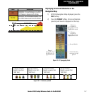

Garmin G1000 Cockpit Reference Guide for the DA40/40F
10-3
SECTION 10 – HAZARD
AVOIDANCE
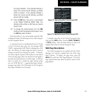
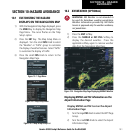
ECHO TOP – Press the ECHO TOP Softkey to show
the location, elevation, and direction the highest
radar echo. This may not indicate the top of a
storm or clouds, only the highest radar return
echo. ECHO TOPS cannot be displayed along
with NEXRAD and CLOUD TOPS. When ECHO
TOPS is activated, NEXRAD and CLOUD TOPS are
removed. Refer to the Legend for a description of
the ECHO TOPS coding. The display is updated
every 7.5 minutes.
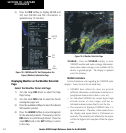
CLD TOP – Press the CLD TOP Softkey to show the
cloud top altitude determined from satellite imagery.
The display is updated every 15 minutes.
LTNG – Pressing the LTNG Softkey shows the location
of cloud-to-ground lightning strikes. The display is
updated every five minutes.
NOTE: Strikes depicted represent cloud to ground
strikes within a 2 kilometer radius of the actual
strike location. Therefore, the exact location of
the strike is not displayed.
CELL MOV – Pressing the CELL MOV Softkey shows
storm cell movement by displaying an arrow.
pointing in the direction of predicted movement.
The display is updated every 12 minutes.
SIG/AIR – Pressing the SIG/AIR Softkey shows
SIGMET and AIRMET information.
The display is
updated every 12 minutes.
METAR – Press the METAR Softkey to graphically
display METARs. METARS are shown as colored
flags at airports providing METAR reports. The
display is updated every 12 minutes.
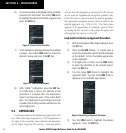
MORE WX – Press the MORE WX Softkey to display
the following group of softkeys for additional
weather control:
SFC – Pressing the SFC Softkey for Surface Analysis
shows current or forecast conditions. Forecasts
are available for intervals of Current, 12, 24, 36,
and 48 hours. Press the softkey corresponding
to the desired forecast. The closest city forecast
information is displayed in the legend. The
display is updated every 12 minutes.
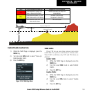
FRZ LVL – Press the FRZ LVL Softkey to display
contour lines for freezing levels.
The display is
updated every 12 minutes.
WIND – Press the WIND Softkey to show wind
speed and direction at a selected altitude from
the ground up to 42,000 feet in 3,000 foot
increments. After pressing the
WIND Softkey,
press the softkey corresponding to the desired
winds aloft altitude. The display is updated every
12 minutes.
COUNTY – Pressing the COUNTY Softkey provides
specific public awareness and protection
weather
warnings for Tornado, Severe Thunderstorm,
and Flood conditions provided by the National
Weather Service (NWS). The display is updated
every 5 minutes.
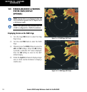
CYCLONE – Pressing the CYCLONE Softkey shows
the current location of cyclones (hurricanes and
tropical storms) and their projected track at
various time intervals. The display is updated
every 12 minutes.
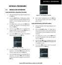
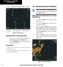
Map Panning Information – Weather Data Link
Page
1) Push in the
Joystick
to display the panning
arrow.
2) Move the
Joystick
to place the panning arrow
on AIRMETs, TFRs, METARs, or SIGMETs. Press
the ENT Key to display pertinent information
for the selected product.