


Reference
40
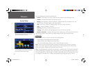
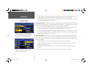
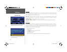
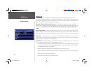
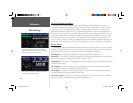
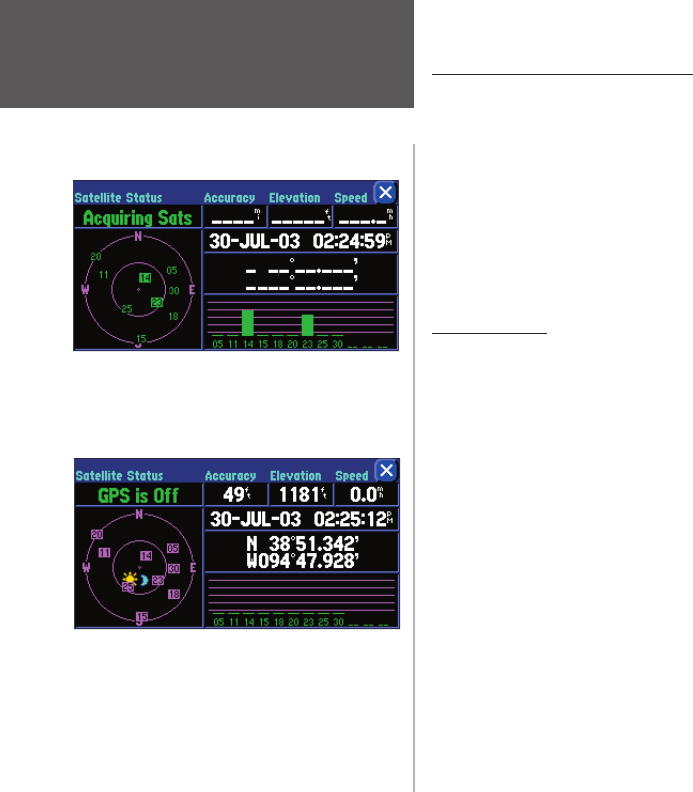
Sky View and Signal Strength Bars
The sky view and signal strength bars give you an indication of which satellites are currently vis-
ible, which satellites are being used to calculate a position fi x, and the signal quality. The sky view shows
a “bird’s eye” view of each satellite position relative to the unit’s last known position. The outer circle
represents the horizon in all directions (with cardinal heading references). The inner circle represents an
elevation of 45° above the horizon. Any satellite depicted near the center is directly overhead. You can use
the sky view to help determine whether any satellites are being blocked and whether you have a current
position fi x (indicated by ‘2D Navigation’ or ‘3D Navigation’ in the status fi eld). You can also set the sky
view to a ‘Track Up’ instead of ‘North Up’ confi guration (under the ‘Orientation’ fi eld of the ‘Map’ tab page
under ‘Map Setup’), causing the top of the sky view to align to your current track heading. (See page 42)
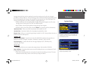
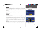
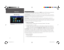
Receiver Status
As soon as the StreetPilot 2610/2650 has collected the necessary data to calculate a fi x, the status fi eld
indicates a 2D or 3D status (for ‘2D’, you may need to enter your elevation). Receiver status is indicated at
the top left corner of the page. The status is shown as one of the following conditions:
Searching Sky – The StreetPilot 2610/2650 is looking for any available satellites in view.
AutoLocate – The StreetPilot 2610/2650 is initializing and collecting new almanac data. This process can
take up to fi ve minutes, depending on the satellites currently in view.
Acquiring Sats – The receiver is collecting data from available satellites, but has not collected enough data
to calculate a position fi x.
2D Navigation – At least three satellites with good geometry have been locked onto and a two-dimen-
sional position fi x (latitude and longitude) is being calculated.
3D Navigation – At least four satellites with good geometry have been locked onto and your position is
now being calculated in latitude, longitude and elevation.
Poor GPS Coverage – The receiver isn’t tracking enough satellites for a 2D or 3D fi x due to bad satellite
geometry or due to a shaded antenna (driving between buildings, etc.)
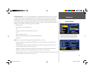
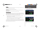
‘Acquiring Sats’ means the receiver is collecting
data from available satellites but has not collected
enough data to calculate a position fi x.
‘GPS is Off’ tells you the unit is being used indoors
and cannot be used for navigation.
GPS Info Page
2610_2650 OM.indd 40 8/1/2003, 4:16:06 PM