


Reference
12
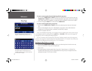
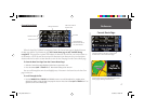
Common Settings
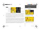
Text Size — Specifi es the text size that a map item display. Selecting ‘None’ turns off the text display for
that item.
Max Zoom — Specifi es the maximum map scale at which a map item displays. If ‘Auto’ is selected, the
maximum map scale is determined by the ‘Detail’ setting to prevent map clutter. If ‘Off’ is selected, the item
won’t be shown.
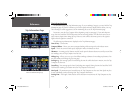
Map Options
Map Detail— Adjusts the amount of map information, such as roads, that is displayed. ‘Most’ shows
maximum detail and ‘Least’ shows minimum detail. The higher level of detail, the slower the map redraw-
ing time.
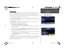
Orientation — Selecting ‘North Up’ displays the map with North at the top. Selecting ‘Track Up’ auto-
matically rotates the map to keep your current direction of travel at the top of the screen. A white ‘North’
indicator is displayed on the map when in the ‘Track Up’ mode. The indicator always points to North. An
‘N’ with a black arrow pointing up displays while in ‘North Up’ To quickly change the map orientation,
TOUCH the ‘Orientation’ icon in the upper left to toggle between ‘North Up’ and ‘Track Up’.
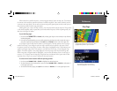
Color Mode — Select between Day, Night, or Automatic for best viewing conditions. ‘Day’ shows mostly
a yellow background, ‘Night’ shows a black background for less intensity in a dark environment, for easier
viewing while driving at night. ‘Automatic’ switches between day and night automatically.
AutoZoom — When ‘On’, this option automatically adjusts the map scale to show both your current loca-
tion and the next item to which you are navigating.
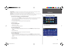
Line Options
Track Log — Controls the display of the Track Log on the map.
Railroad — Controls the display of railroads on the map.
Street Label — Controls the display of street names on the map.
Other Options
Point Tab — Controls the display of waypoints, exits, and POIs (points of interest) on the map.
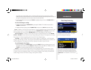
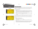
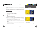
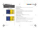
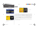
The Options menu on the Map page allows you to
customize the Map page.
Map Page Options
2610_2650 OM.indd 12 8/1/2003, 4:15:47 PM