


1-43
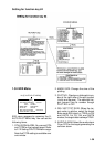
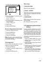
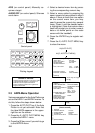
Latitude and longitude area
[ENTER MARK]
0000.000 N/S
5-N 6-S
000.000 E/W
7-E 8-W
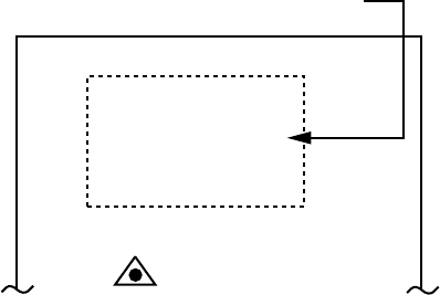
MARK 01
01.
2. Key in the latitude. If necessary, press
the following key.
[5] key; N, [6] key; S
3. Key in the longitude. If necessary, press
the following key.
[7] key; E, [8] key; W
4. Select mark.
5. Press the ENTER key.
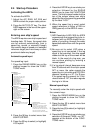
By own ship position entry mode
1. Press the VIDEO PLOT key.
2. Press the MARK key.
3. Enter mark number.
4. Press the ENTER key.
Note: Waypoints used to make NAV lines,
as described on page 1-40, can be erased
on the NAV LINE menu.
Chart alignment
You can align the chart data and radar
image, by using the ALIGN key.
1. Press the ALIGN key.
2. Operate the trackball to align the chart
on the radar.
3. Press the ALIGN key to fix.
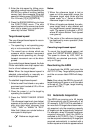
Other items
3. NAV DATA POSN:
Reset the chart alignment.
4. ALIGN + CURSOR
Select ON, plus the alignment rate to the
cursor data which is appeared at the lower
of the display.
6. ERASE MARK
AREA; Erase all marks on the current ap-
pearing display.
ALL; Erase all marks in the CPU.
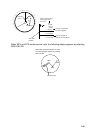
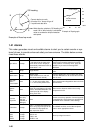
1.37 Suppressing Second-trace
Echoes
In certain situations, echoes from very dis-
tant targets may appear as false echoes
(second-trace echoes) on the screen. This
occurs when the return echo is received
one transmission cycle later, that is, after
a next radar pulse has been transmitted.
To activate or deactivate the second-trace
echo rejector:
1. Press the RADAR MENU key on the
plotting keypad to show the FUNC-
TIONS menu.
2. Press the [8] key to select menu item 8
2ND ECHO REJ.
3. Further press the [8] key to activate
(ON) or deactivate (OFF) the second-
trace echo rejector.
4. Press the ENTER key to conclude se-
lection followed by the RADAR MENU
key to close the FUNCTIONS menu.