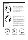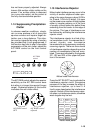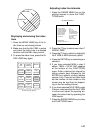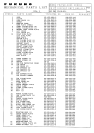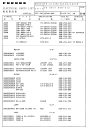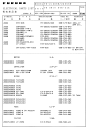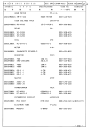
1-42
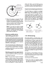
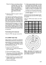
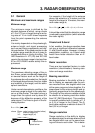
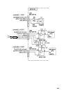
1.36 Radar Map
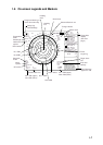
A radar map is combination of map lines
and symbols whereby the user can de-
fine and input the navigation, route plan-
ning and monitoring data on the radar
equipment. Map lines are navigational
facility whereby the observer can define
lines to indicate channels or traffic sepa-
ration schemes. Also called nav lines,
these line can be ground stabilized to stop
them drifting. (Definition in Annex C of IEC
60936-1 and IEC 60872-1)
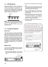
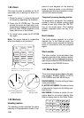
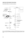
Marking radar map
Select mark entry mode as follows.
1. Press the NAV MENU key to display
the NAV INFORMATION 1 menu.
2. Press [1] key to display the RADAR
MAP menu.
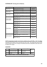
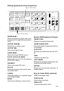
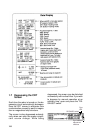
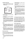
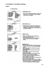
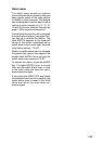
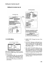
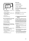
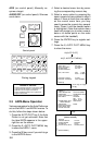
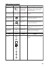
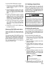
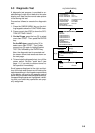
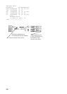
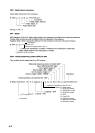
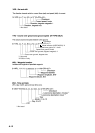
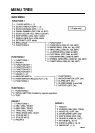
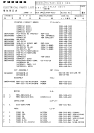
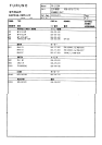
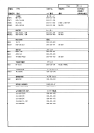
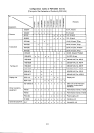
[RADAR MAP]
1 [NAV INFORMATION 1]
2 MAP
OFF/ON
3 NAV DATA POSN
4 ALIGN +CURSOR
OFF/ON
5 MARK ENTRY MODE
CORSOR/L/L/OWN SHIP POSN
6 ERASE MARK
OFF/AREA/ALL
3. Press [2] key to twice to select ON, and
then press the ENTER key. MAP indi-
cation appears at the right-hand of the
screen.
4. Press [5] key several times to select
the entry mode, cursor, L/L or own ship
position.
5. Press the ENTER key followed by the
NAV MENU key.
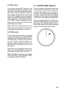
A radar map contain 1500 points of mark
and line data.
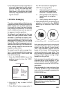
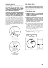
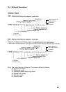
Mark a radar map as follows.
By Cursor position;
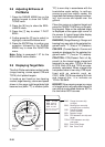
1. Press the MARK key to display the EN-
TER MARK menu.
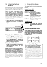
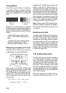
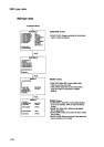
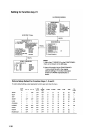
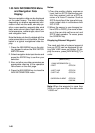
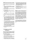
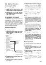
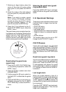
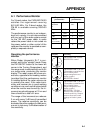
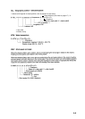
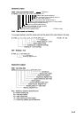
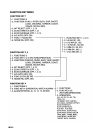
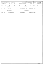
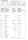
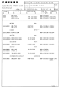
[ENTER MARK]
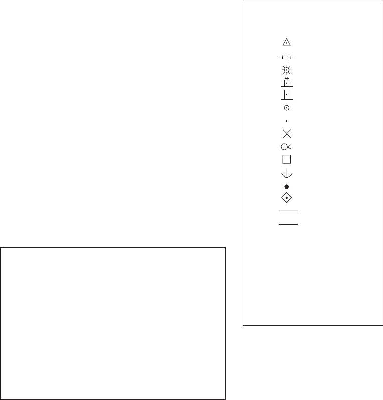
MARK 01
01.
02.
03.
04.
05.
06.
07.
08.
09.
10.
11.
12.
13.
14.
15.
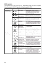
16. NAV LINE
17. COAST LINE
18. CONTOUR LINE
19. PROHIBITED AREAS
20.CABLE
21.LINE CHANGE
22.MARK CANCEL*
*The mark cancel may be used when
the new line is entered at the other position
after marking a line by using the same number mark.
2. Enter mark number to select desired
mark, followed by the ENTER key.
3. Place + cursor an appropriate point.
4. Press the ENTER key.
5. Repeat steps 2 to 4 above. To enter
the same mark selected at step 2, sim-
ply repeat step 3 and 4.
6. To escape the mark entry mode, press
the MARK key.
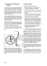
By L/L position entry mode
1. Press the MARK key to display the EN-
TER MARK menu. On L/L entry mode,
the latitude and longitude are appears.