


Chapter 3: Operation 3-5
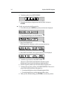
Waypoint data display
Waypoint data can be viewed in two ways: you can use the cursor to select the
waypoint to display the waypoint data in the status bar at the top of the screen,
or you can view waypoint details on the waypoint list.
To display waypoint data:
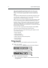
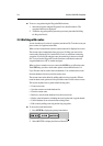
Move the cursor over the waypoint. The waypoint data is displayed in the status
bar, indicating waypoint number/name, bearing and range.
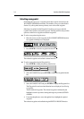
Whilst the cursor is over the waypoint, the WAYPOINT OPTIONS function
bar is displayed.
To remove the waypoint data :
Move the cursor away from the waypoint or press CLEAR.
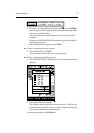
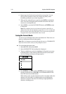
To display the waypoint details from the waypoint list:
Select the waypoint in the list as described above.
The details for the selected waypoint are displayed in the lower half of the
window. Date and time are included for all waypoints.
To remove the Waypoint List and return to chart mode, press CLEAR twice.
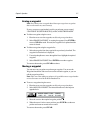
Editing the waypoint details
You can change the name, symbol and position of a waypoint, which can be
achieved either by means of the cursor or via the Waypoint List.
Note: You cannot edit the target waypoint.
To edit a waypoint using the cursor:
1. Place the cursor over the waypoint, see Selecting a waypoint above.
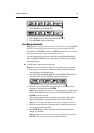
2. Select EDIT WAYPOINT. The Edit Waypoint function bar is displayed:
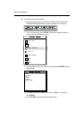
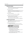
3. To edit the waypoint name, select EDIT NAME.
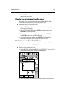
The NAME WAYPOINT window is displayed.
Use the trackpad to enter or edit the name as follows:
• Use trackpad left/right to move the cursor to the character you wish to
change. Up to eight characters can be used.
• Use trackpad up/down to scroll through the characters.
When you have finished editing the name press ENTER. The waypoint
name is updated and the window is removed