


170
Control systems
COMAND navigation (introduction)
̈ Exiting menu: Slide omp or press
back button L in the center console
(
୴ page 86).
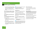
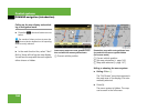
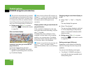
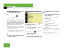
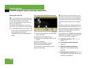
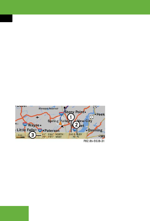
Geo-coordinate display
Illustration: map with geo-coordinate dis-
play switched on
1 Current height above sea level
2 Number of GPS satellites from which
signals for positioning can be received
3 Coordinate display
Display options with geo-coordinate dis-
play switched on
If the crosshair is displayed on the map
view (map was moved manually), only dis-
play 3 is visible.
It shows either the coordinates of the
crosshair or other data on the crosshair
position, e.g. a street name. The digital
map must contain relevant data in order
for this other data to be displayed.
Switching the geo-coordinate display on
or off
̈ Select “Navi” Ǟ “Navi” Ǟ “Map Dis-
play”.
The map display list appears.
̈ Select “Coordinates”.
The geo-coordinate display is switched
on or off, depending on the previous
status. A checkmark indicates which
status is active.
̈ Exiting menu: Slide omp or press
back button L in the center console
(
୴ page 86).
Setting route type (USA only)
Depending on your vehicle’s production
date the route type function may not be
available.
You can set the following route types:
ț “Fast Route”: COMAND calculates a
route with the shortest possible (mini-
mized) driving time.
i
The list shows all symbols that are contained
in the digital map across all states (USA) and/or
provinces (CDN). Not all POIs in all states (USA)
or in all provinces (CDN) are available, however.
Certain POI symbols may not be displayed on the
map, even if the symbol display is switched on.
i
There must be sufficient GPS reception for
displays 1, 2 and 3 to be shown. Height dis-
play 1 is an approximation because the naviga-
tion system uses the GPS signals for the
calculation.
i
If there is no crosshair on the map view, dis-
plays 1, 2 and 3 are visible. Display 3
shows the coordinates of the current vehicle po-
sition.