


Magellan NAV 6500/NAV 6510 15
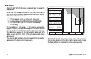
Track Plot Mode
Track Plot Mode allows you to go where no man has gone
before - or at least where your chart does not provide detailed
navigation information - by displaying a LAT/LON grid with-
out background cartography.
Though you can use this feature to plot and
retrace your course conveniently using coordinates
alone, EXTREME CAUTION IS REQUIRED
when using the Track Plot Mode. The Track Plot
Mode should never be used as a sole means of
navigation. Paper charts are required.
If a cartridge is not installed, zooming into a scale not sup-
ported by the built-in map activates the Track Plot mode. If a
cartridge is installed, zooming into a scale not supported by
either the cartridge or the internal map also activates the Track
Plot mode.
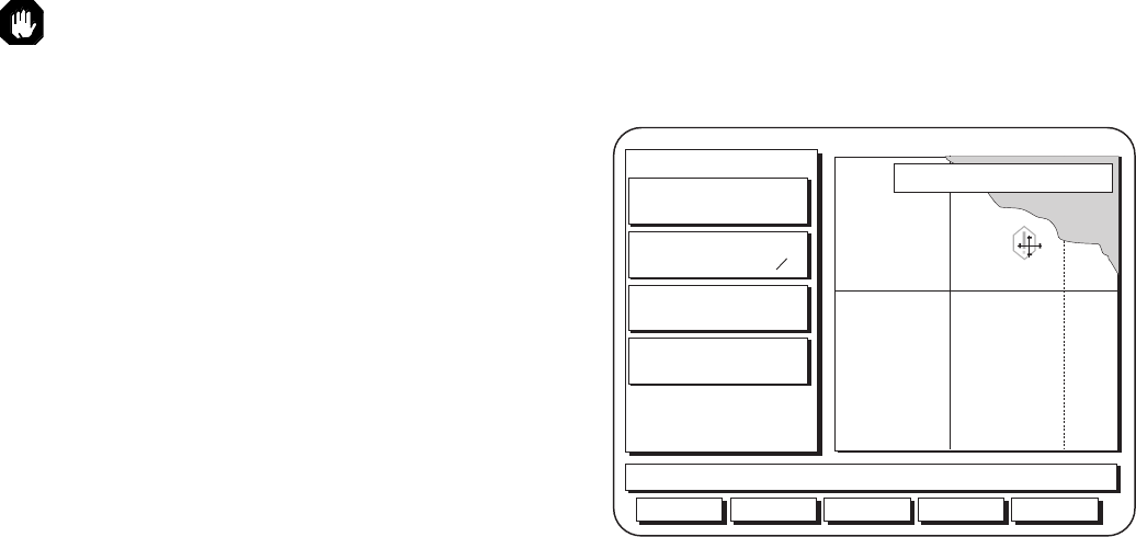
In this mode, the LAT/LON grid and label are turned on
automatically, even if they are off in the Map Configuration
and a warning appears for two seconds to let you know you
have zoomed to a scale not supported by cartography.
Track Plot Mode then plots the route you are traveling on a
grid showing coordinates, without background cartography.
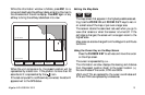
Viewing Nav-Aid Attributes
Map objects appear as icons on the map. The
Nav-Aids (buoys, lights, signals, etc.) and other objects are
part of the cartography such as rocks, wrecks, etc. See Appen-
dix for a list of map objects.
Object attributes appear instantly on the map screen in a
QUICK INFO window when the cursor covers an icon, giv-
ing a description of the object or objects. The abbreviated
description is similar in format and content to what you would
see in a standard paper chart.
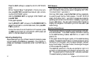
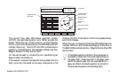
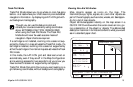
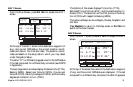
Aux Waypts NxtScrn
Use Cursor & ENT to set reference pnt
To Cursor
BRG 035` M
DTG 7061.
n
m
COG 164` M
SOG 0.9
XTE --.-
TRN ---`
33`20'66"N
117`31'94"W
GPS Fix
Scale: 6
k
h
n
m
Underwater rock
Routes Hide