


Magellan NAV 6500/NAV 6510 13
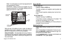
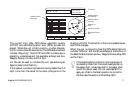
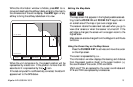
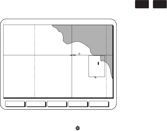
When the unit computes a fix, the present position will be
represented by a boat icon. If the position is more than 20
seconds old it is represented by the (
) icon.
If the last computed fix is differentially corrected, the letter D
appears next to the GPS status.
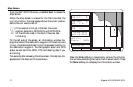
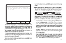
While the information window is hidden, press ESC to re-
move and deactivate the softkey labels, enlarging the map to
the dimensions of the entire display. Press ESC again or any
softkey to bring the softkey labels back into view.
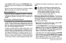
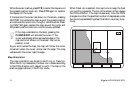
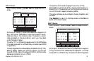
Setting the Map Scale
ZOOM
IN
ZOOM
OUT
The map screen first appears in the highest possible scale set-
ting. Use the ZOOM IN and ZOOM OUT keys to zero in
on a small area of the map or pan over a larger area.
The receiver retains the scale level last used when you go to
view other screens or when the receiver is turned off. If the
cartridge is changed, the screen will once again zoom to the
highest scale.
Map scale can also be changed from the Waypoint and Route
functions.
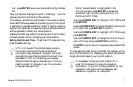
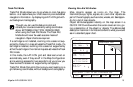
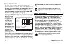
Using the Cursor Key on the Map Screen
Press the CURSOR KEY to activate and move the cursor
on the Map screen.
The cursor is represented by a
+ .
The information window displays the bearing and distance
from the present position (boat) to the cursor location (+),
the coordinates of the cursor, COG and SOG.
VMG and TTG are replaced by the cursor coordinates and
XTE and TRN are replaced by underscores.
Aux Waypts Routes NxtScrn
Los Angel
Show
N 34 00 00.00
N 32 00 00.00