


Advanced Features
63
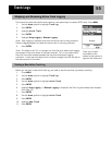
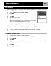
1. With the Sun/Moon screen displayed, highlight the On field.
2. Press ENTER.
3. Use the Arrow joystick to change the date.
Up/Down changes the data at the cursor position; Left/Right moves the cursor.
4. When the date is correct, press ENTER.
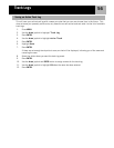
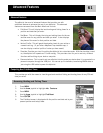
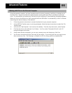
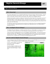
Vertical Profile will graphically display the elevation for a track log that you select. This can be your active
track log or one you have saved. If you have loaded a detail map from one of the MapSend Topographic
software packages, you can also view the vertical profile for routes you have created.
1. Press MENU.
2. Use the Arrow joystick to highlight Adv. Features.
3. Press ENTER.
4. Use the Arrow joystick to highlight Vertical Profile.
5. Press ENTER.
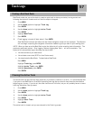
6. Highlight Track History. (When a MapSend Topograhic detailed map has been loaded, you can
select one of the other available options.)
7. Press ENTER.
8. Highlight Active Track or saved track that you want to view.
9. Press ENTER.
The vertical profile for the selected item is displayed. You can use the Arrow joystick to move the
displayed profile left or right. As you move the profile, the center mark will display the elevation for the
point indicated.
Changing the Date
Viewing the Vertical Profile