


72
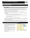
MapSend® is the Magellan line of detailed digital maps for Magellan hand-held GPS receivers. The core
MapSend product line includes street maps for driving, topographic maps for hiking, camping, and hunting,
and fresh/salt water maps for fishing and boating. MapSend maps will transform your eXplorist into an
amazingly powerful solution for outdoor recreation and travel.
You can find out more about the growing line of MapSend products through a Magellan dealer or on-line
www.magellangps.com under Products > Maps and Software.
Most MapSend products are provided on CD-ROM for use on personal computers using the Windows®
operating system.
• MapSend maps typically cover large areas, allowing the user to ‘cut’ smaller regions to be uploaded
and saved as one of the detailed maps available for your eXplorist.
• Other useful trip planning and map analysis functions, such as the ability to easily create and store
POIs, routes, map regions, etc.
• Plug and play in the eXplorist, but are limited in geographic area.
Please note that not all MapSend products will presently work with the eXplorist. Please check the Magellan
web site at www.magellangps.com and and go the the eXplorist web for a link to details on compatibility with
your eXplorist and MapSend software.
The following instructions are basic guidelines for using MapSend with your eXplorist. Please refer to the
documentation provided with your MapSend product for more detailed information and product updates.
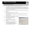
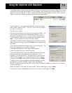
Install MapSend Software. Following the instructions
provided with the MapSend product you purchased,
the first step is to install the software onto your
personal computer. For this overview, the MapSend
Topo 3D will be used.
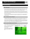
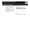
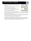
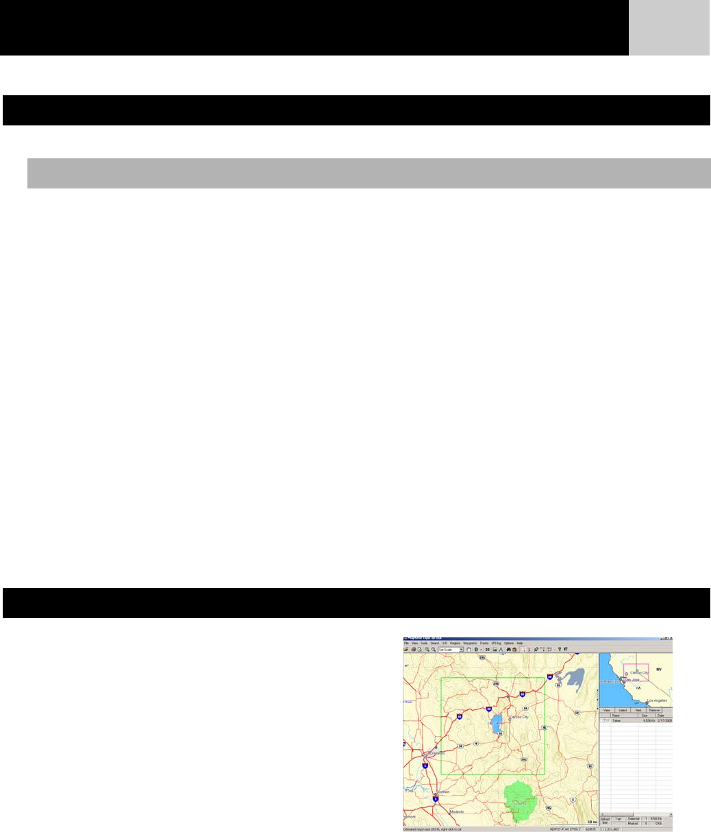
Open MapSend and Define a Region. Zoom in and
pan until you find an area that you are interested in.
Using the Draw New Region tool, define the region.
Right-click inside the region. This will bring up a
window for you to enter a name for the region. In this
example it is called “Tahoe.”
Notice that in the lower right corner the size of the
region is displayed.
Using the eXplorist with MapSend
What is MapSend?
Overview of Uploading Detail Maps from MapSend to the eXplorist
Using the eXplorist with MapSend