LX 7007 pro IGC V1.0 Apr.2005
Page 22
Note!:
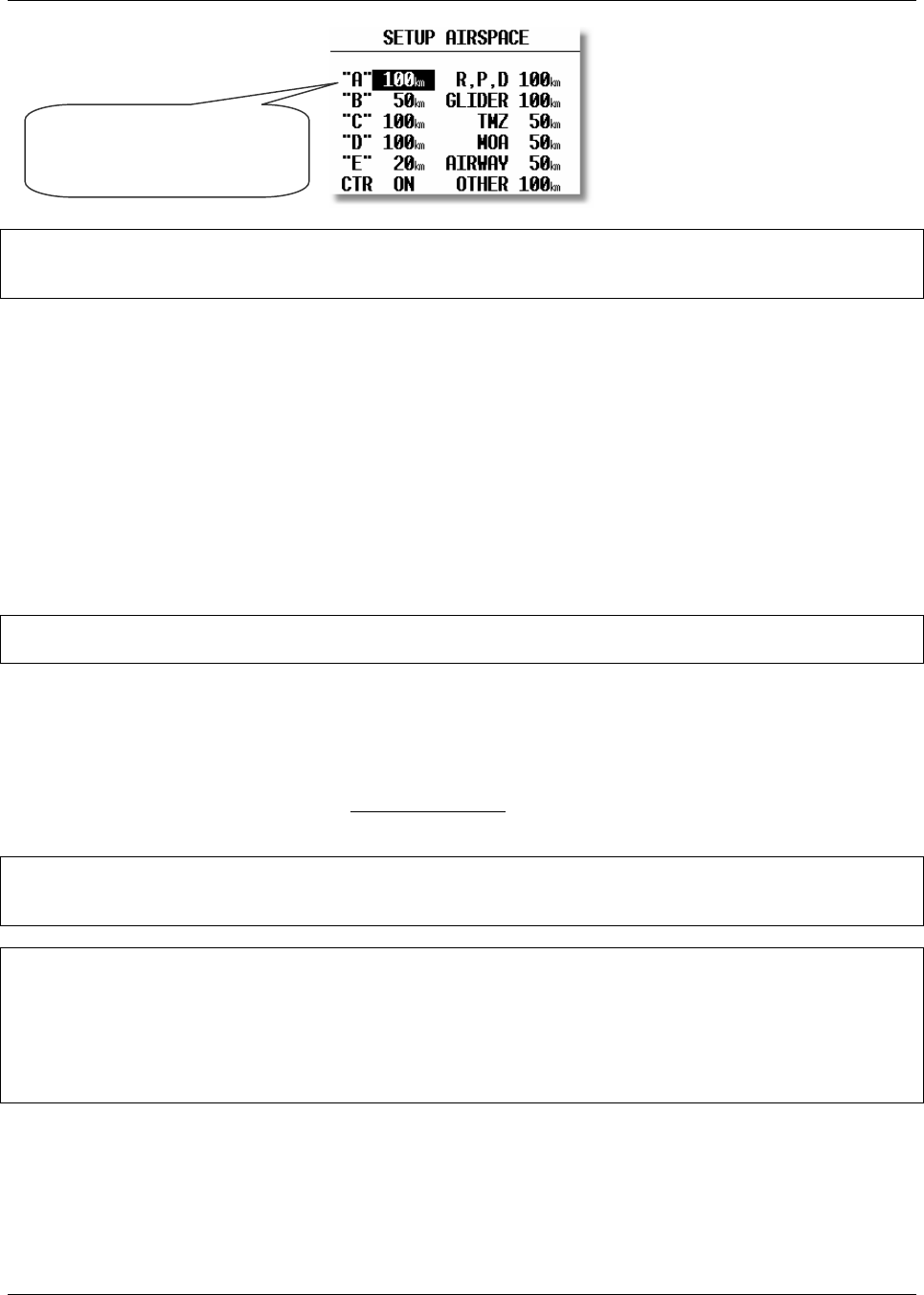
If, for instance, 100 km is selected, then the airspace will only be shown when the ZOOM range is 100 km or lower.
When the ZOOM range is greater than 100 km, the particular airspace will not be shown.
The LX7000 allows the following types of airspace to be shown:
• Class A
• Class B
• Class C
• Class D
• Class E
• CTR. Control zone
• R.P,D Restricted, Prohibited and Danger areas
• GLIDER
• TMZ Transponder mandatory zones
• MOA Military operating areas
• AIRWAY
• OTHER
Note!
CTRs are marked using a bold line, so the pilot is able to separate CTRs from other airspace very quickly.
Airspace Customization
A completely new feature of the LX 7007 pro IGC V2.0 is that pilots can customize their own airspace files. Pilots are
able to create areas, or to add and remove particular airspace according to their personal requirements. All
customization is done using the well known “Open Air format” or “Tim Newport Piece format”. Detailed
instructions on customization are described in a separate document, the LxasBrowser manual. This manual is supplied
with each instrument and is also available on www.lxnavigation.si
. Restricting the creation of airspace to a dedicated
area where the pilot is usually flying will make the instrument much faster when operating the ZOOM function.
Note!:
All airspace files used with LX7000 v2.0 must have the .CUB extension; it is not possible to load old airspace format
files. The new airspace files can be created and loaded using Lxe build July 15th 2003 or later.
Note!:
To be able to use all the benefits of the airspace graphics and warnings, it is recommended that some time is taken to
study the airspace of the task area. All irrelevant zones should be deleted so that the speed of graphical presentation
remains fast and unnecessary airspace warnings are avoided. Some TMAs are built from many sectors and is
recommended that these sectors are amalgamated into one large TMA definition, if possible. After modification of
.LXW files it is essential that a new .CUB file is built. LXW is a new airspace data base format described in the
LxasBrowser manual or on the www.lxnavigation.si website.
APT GRAPHICS (Airports)
Airports are displayed with aerodrome symbols together with their name which can be configured in variety of ways.
Class A will only be shown
when the ZOOM scale is
100km or lower


