


WARNING!
USE THIS
MAPPING UNIT ONLY AS AN AID TO NAVIGATION.
A
CAREFUL
NAVIGATOR NEVER RELIES ON ONLY ONE METHOD
TO
OBTAIN POSITION
INFORMATION.
The
background maps
built
into this unit are not intended for
navigation.
The
accuracy
of these
maps
has not been verified. The
maps
are derived
from U.S. Government
sources which
rely
on
ground
and aerial
surveys
and satellite data.
Since there can be inaccuracies in the data used to
create the
map
and the
maps
resolution,
and
position
inaccuracies in
the
navigation
system, you
should use caution when
using
this
product.
CAUTION
When
showing navigation
data to a
position (waypoint),
this unit will show
the
shortest,
most direct
path
to the
waypoint regardless
of obstacles.
Therefore,
the
prudent navigator
will not
only
take
advantage
of all
available
navigation
tools when
travelling
to a
waypoint,
but will also
visually
check to make certain a
clear,
safe
path
to the
waypoint
is
always
available.
NOTICE!
As of this
writing,
the
Department
of
Defense
(DOD)
has not declared the
GPS
navigation system operational.
The
system
is still in a
testing phase.
Satellites
can be
turned off or
accuracy
can be
degraded
at will
by
the
system operators.
Remember
this
if
you
use a GPS receiver as the
position input
to the
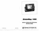
GlobalMap
1000.
C-MAFI
CMAPTM
The CMAPTM database
is not intended as a
replacement
of official
nautical charts which are
required
for safe
navigation.
Copyright®
1993 Lowrance
Electronics,
Inc.
All
rights
reserved.
All features and
specifications subject
to
change
without notice.
All screens in this manual
are simulated.
NOTES:
PDF compression, OCR, web-optimization with CVISION's PdfCompressor