


18
Reference
Map Panning
Arrow Pointer Panning
Reviewing a Selected Waypoint
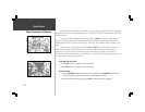
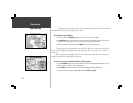
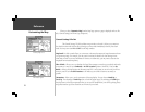
The pan function, which allows you to identify features on the map, and to move the map to
view additional areas not currently shown on the screen.
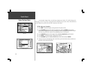
To activate the pan function:
1. Press any area of the ROCKER keypad to cause the arrow pointer to appear.
2. Use ROCKER keypad to move the arrow in any direction. The direction and distance from your
location to the arrow pointer is shown at the top of the map. (top left picture.)
3. When you have finished panning, press ENTER to remove the panning arrow.
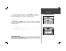
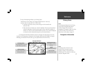
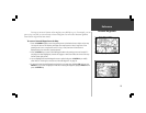
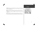
The arrow serves as a target marker for the map. When placed on a map feature, the name of
feature will be highlighted. This applies to Personal Waypoints, roads, cities, lakes, rivers, Points of
Interest, etc.
When a map feature is highlighted, you can review information about that feature and go to it
using the StreetPilot directional guidance to get there.
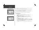
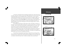
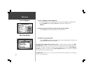
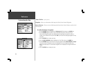
To select an on-screen location with the panning arrow:
1. Use the ROCKER keypad to move the panning arrow to the desired Personal Waypoint, City, or
point of Interest, as shown in the top left picture.
2. Press ENTER to review information for the selected waypoint (bottom left picture)
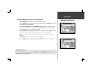
3. To go back to the Map Page, highlight OK and press ENTER (or QUIT).