


16
Reference
Zooming
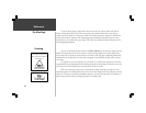
If you are driving along a road which is shown on the map, the vehicle pointer will often be
shown moving right down the road. This occurs when your location and direction you are driving
indicate that you probably are on that street. While the StreetPilot performs at optimum to indicate the
correct street, there are occasions when the Map Page may momentarily indicate that you are on one
street when you are actually driving on another. This is due to the inherent accuracy limitations of GPS
and the mapping information.
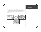
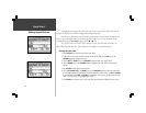
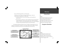
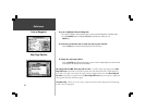
By now, you should be familiar with the Zoom IN and OUT keys, and how they change the map
display. The map scale is shown at the lower left corner of the map display area. In the example at the
left, the map scale is 150 meters between the two tick marks. If the map page is displaying MetroGuide
information from the Map Data Card, the word ‘metroguide’ is inserted below the map scale, as shown
to the right.
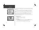
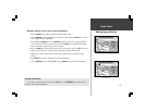
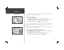
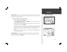
It is possible to zoom the Map Page to a scale which is too small for the resolution of the stored
map information to be displayed with out sacrificing the quality of the resolution. When this occurs, the
word ‘overzoom’ will be inserted below the map scale, as shown to the left.
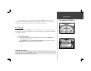
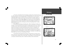
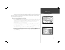
When you are driving on city streets or roads that are within a Map Data coverage area, more
detailed map scales (for example 300 meters or less) may be more helpful, since they provide you with a
good view of all streets, not merely thoroughfares. However, you may find map scales of 2 kilometers or
greater more practical for freeway driving, especially in non-urban areas.
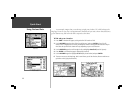
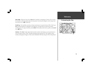
The distance between
these two tick marks is
150 meters.
The Map Page