


Reference
15
The Map Page
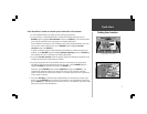
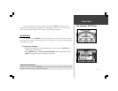
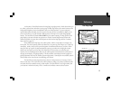
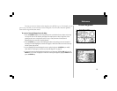
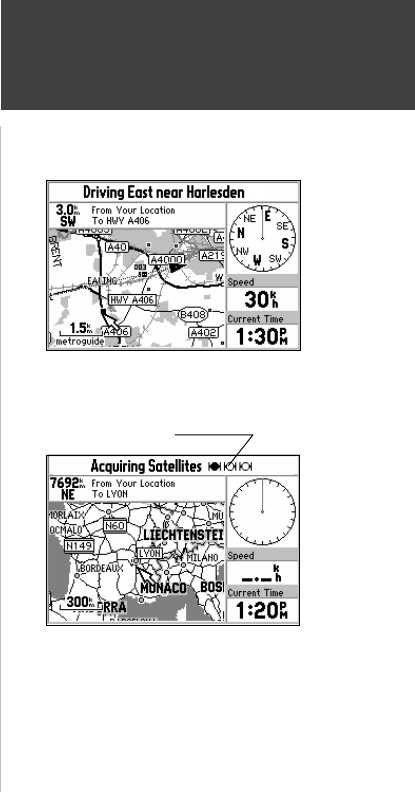
At the center of StreetPilot features is the Map Page (top right picture), which shows where you
are, where you have been, and where you are going. The Map Page shows your current location on the
background of highways, major thoroughfares, lakes, rivers and coastlines. If you are using and
optional MetroGuide cartridge, most city streets for that area will also be available for display. An on-
screen cursor allows you to pan around to different areas of the map to view roads and geographic
features. The StreetPilot also features IN and OUT keys for instant zooming. The map portion of the
page displays your current location as a pointer icon. Nearby Personal Waypoints are shown with
names and symbols. You may select which objects are shown on the Map Page with the ‘Customize
Map’ option (see page 22).
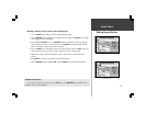
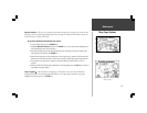
At the middle of the Map Page is the vehicle pointer, which is in the shape of a triangle or an
arrow point. The vehicle pointer points in the direction you are moving. If the map is set to ‘North Up’
orientation, north is always at the top and the pointer turns different directions as you drive. When
using the ‘Track up” option, the map automatically rotates as you make turns, keeping the current
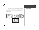
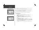
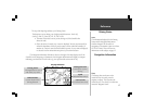
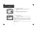
direction of travel at the top of the map. If the StreetPilot GPS receiver has yet to calculate your
location, there is a flashing question mark over the vehicle pointer and the status line at the bottom of
the page screen displays, ‘Acquiring Satellites’. The three satellite icons indicate the unit’s progress in
getting information from the GPS satellites (bottom right picture). Generally, the more satellite symbols
that are filled-in, the closer the unit is establishing your location.
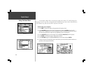
The StreetPilot’s accuracy depends on many factors. In many instances an ‘Accuracy Circle’ is
shown on the screen. This screen shows the vehicle pointer according to its position calculations and a
circle that shows the estimated accuracy at that moment. The StreetPilot has a very high certainty that
your location is within the Accuracy Circle. A smaller circle indicates a more accurate location.
Map Page
Map Page while the StreetPilot is finding your
location
Satellite Icons