


Reference
17
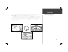
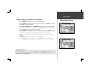
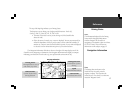
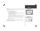
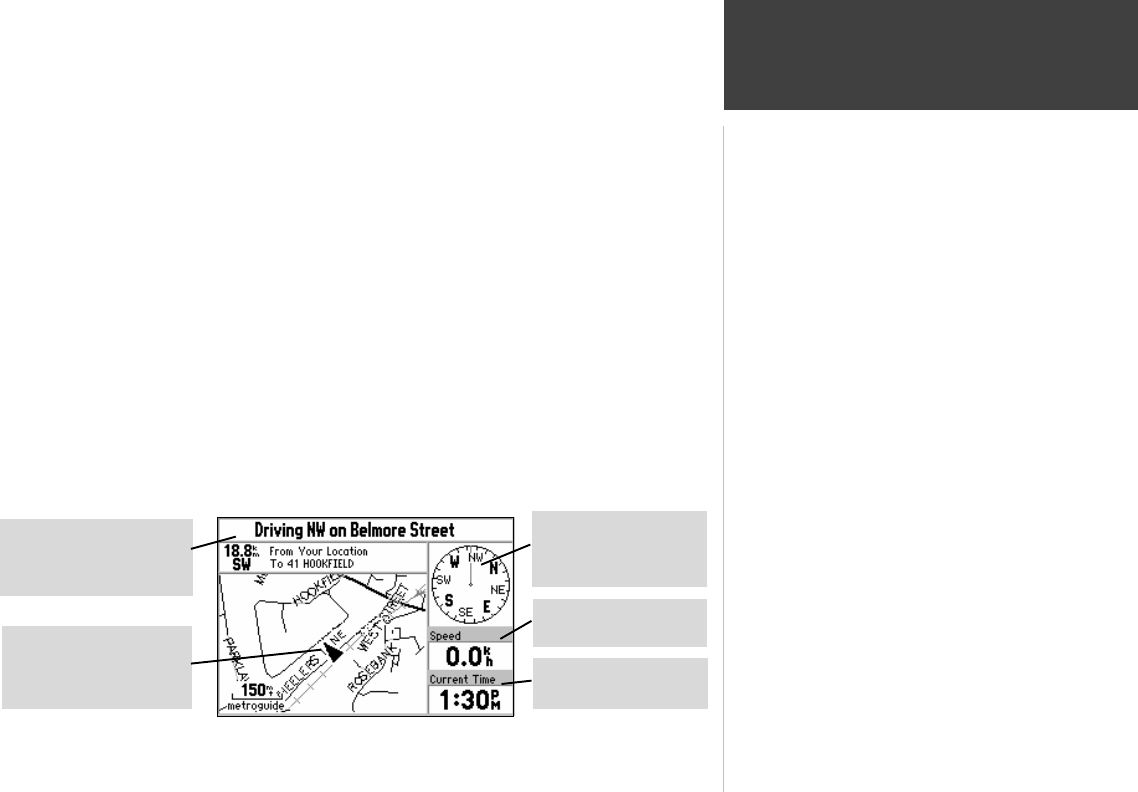
The top of the Map Page indicates your Driving Status:
The direction you are driving; one of eight possible directions - North (N),
South (S), East (E), West (W), NE, SE, SW, or NW.
! The name of the road or street you are driving on (if the StreetPilot has
selected a road).
! Often, the name of a nearby city or town is displayed. You may not necessarily be
within the boundaries of this city, and you may even be within the boundary of
another city. Cities are stored in the StreetPilot as points, if a city name is displayed,
it is because it is the nearest reference point to your current location.
The Navigation Information Window is shown to the right of the map display area. If the
StreetPilot is not navigating to a destination, the Navigation Information area displays a compass
indicating your direction of travel at the top, your speed and the current time of day.
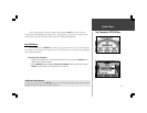
Note:
The driving direction shown on the
StreetPilot may not exactly match a
magnetic compass. This is because the
StreetPilot uses “True North” as a reference
instead of “Magnetic North”.
Note:
The information displayed for the Driving
Status and the Navigation Information
window changes if the StreetPilot is
navigating to a destination, either on a Direct
GOTO or a Route. There will be more
information on this subject on page 52.
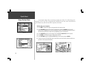
Driving Status
Driving direction, road
and nearby city name
Current Time
For selected time zone
Speed
Miles/kilometers/hour
Driving Direction
The direction you are
driving
Vehicle Pointer
Current location and
driving direction
Navigation Information
Driving Status
Map Page Information