10
Quick-Start
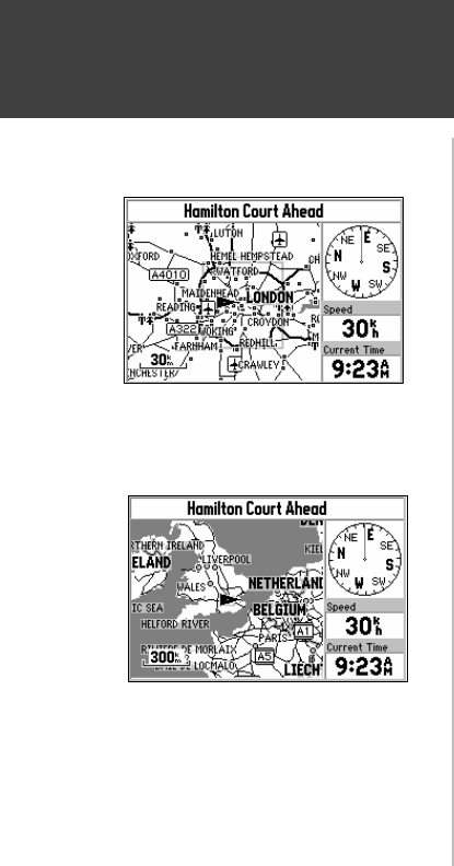
Map Zooming and Panning
Small Area - More Detail
Large Area - Less Detail
Once the StreetPilot calculates your location, you may find it enjoyable just to view the Map Page
and watch your movement along roads and streets. There will be time later to learn about the ‘Find’ and
‘Route’ functions.
If you are not already looking at the Map Page, press the PAGE key until the map is shown on
the screen (top left picture). If the StreetPilot is still trying to determine your position, there will be a
flashing question mark (?) in the center of the map . Otherwise, the StreetPilot is ready to follow as you
drive.
Now, take time to experiment with the Zoom IN and OUT keys. Notice that the further you
zoom in, the more map features that are shown, to the point where every street in the memory is
displayed. If you zoom out to some of the larger views of the map, it is possible to view most of a
continent at one time (bottom left picture). In addition, you can use the rocker keypad to pan from your
current location to other places on the map.
To change the map scale:
Press the IN key to see a smaller area with more detail.
Press the OUT key to see a larger area with less detail.
To pan the map:
1. Press the ROCKER keypad anywhere and an arrow appears. Use the ROCKER keypad to move
the arrow around the map, even to areas not currently shown on the map.
2. When you are finished panning, press the QUIT key. The panning arrow disappears.


