


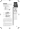
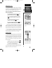
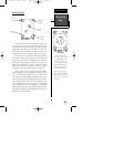
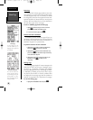
Moving Map Page
The GPSCOM 170 features a powerful real-time mov-
ing map that can do much more than just plot your
course and route. The map page also provides you with a
target cursor that will let you pan ahead to nearby way-
points, determine the distance and bearing to any map
position, and mark new waypoints while you navigate.
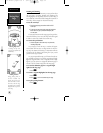
The GPSCOM 170 also features dedicated zoom keys
for instant zooming. The map portion of the page dis-
plays your present position as a diamond icon, with your
track and/or route displayed as small points. Nearby way-
points are represented as squares, with the waypoint
name listed. You may select which features are shown
through the map setup submenu page (see pages 54).
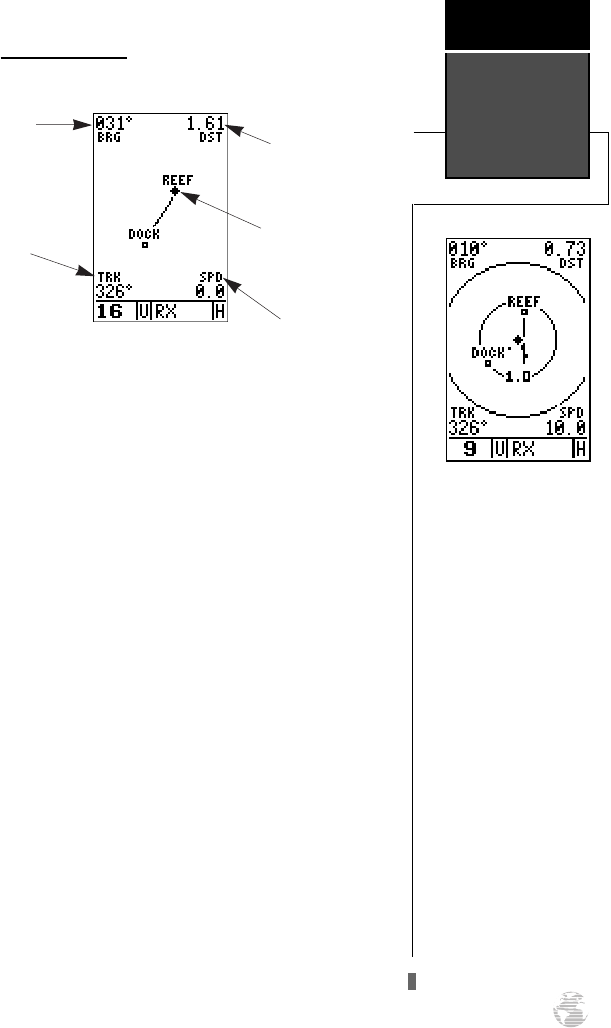
The four corners of the map page are used to display
various navigation data, including the bearing and dis-
tance to a destination waypoint and your current track
and speed over the ground. The two fields at the top cor-
ners of the map show your bearing and distance to one of
three selectable destinations: an active destination way-
point; a highlighted on-screen waypoint; or the panning
target crosshair. If you are not navigating to a waypoint or
using the panning function, the top data fields will not be
displayed. Your current track and speed are shown at the
bottom corners of the display.
Moving Map
Page
Reference
51
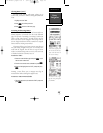
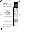
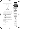
Range Rings
The GPSCOM 170 has on-
screen range rings to help
you estimate distances rela-
tive to your present posi-
tion. The value of each ring
is determined by the current
zoom scale, and is equal to
1/5 of the selected scale.
To turn the range rings dis-
play on or off (the default
setting is off), see the map
setup section instructions
on page 54.
Bearing to
Waypoint
Track Over
Ground
Speed Over
Ground
Distance to
Waypoint
Present
Position
170 manual pages rev D 9/21/98 9:23 AM Page 51