


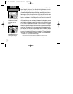
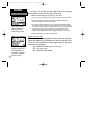

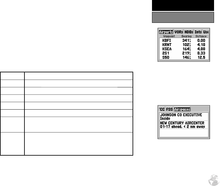
In addition to being used to define a GOTO destination, the GPS III Pilot’s
GOTO/NRST key can also be used to view detailed information on the nine nearest
airports, VORs, NDBs, intersections and user waypoints within 200 miles of your pre-
sent position. Information regarding the five nearest FSS (flight service station) and
center (ARTCC) points of communication, along with associated frequency(s) is avail-
able from the Nearest Page, as well. When an airspace alert is provided, the Nearest
Page will even provide additional detail about the airspace. Nearest information is
selected by choosing the appropriate ‘file tab’, based upon the desired information. The
following table lists the file tabs and information available under each tab:
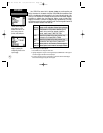
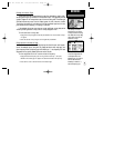
Airports nine nearest with identifier, bearing to and distance
VORs nine nearest with identifier, bearing to and distance
NDBs nine nearest with identifier, bearing to and distance
Ints nine nearest with identifier, bearing to and distance
User Wpts nine nearest with name, bearing to and distance
ARTCC five nearest with bearing to, distance and frequency(s)
FSS five nearest with bearing to, distance, freq(s) and VOR
(for duplex operations)
Airspaces up to three (depending on number of alerts provided)
with type, controlling agency, frequency(s) and floor/
ceiling altitude limits
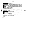
To view the Nearest Page:
1. Press and hold the GOTO/NRST key.
2. Select the desired information by highlighting the appropriate tab from the chart above.
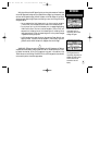
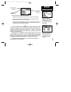
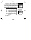
The Nearest Page organizes the
nearest airports, navaids, FSS,
center and airspace informa-
tion by ‘file tab’ headings.
Select the appropriate tab for
the desired information.
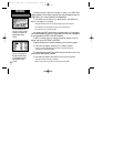
Nearest airspace information
is available on the Nearest
Page, once an airspace alert
has been provided.
53
REFERENCE
Nearest Airports, etc.
GPS III Pilot B2 4/1/99 2:02 PM Page 53