


The GPS III Pilot’s Map Page combines digital charts and Jeppesen data with a
number of user-selectable features. Before we select our destination and begin navi-
gating toward it, let’s take a look at some of those features.
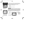
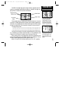
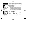
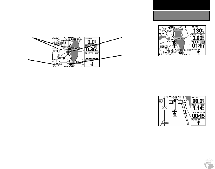
The map display shows your present position using an airplane icon in the center
of the screen. The Map Page also shows any nearby airports, navaids, airspace bound-
aries, lakes, rivers, highways and towns. Use the zoom keys (IN and OUT) to adjust
the map to the desired scale. The current scale is indicated in the lower-left corner.
To change the map scale:
1. Press the IN zoom key to select a smaller scale and display a smaller geographic area.
2. Press the OUT zoom key to select a larger scale and display a larger geographic area.
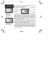
The map can be oriented with the top of the page always pointing north (‘North
Up’), oriented along your desired course (‘Course Up’), or it can automatically rotate
to keep your current direction of travel at the top of the screen (‘Track Up’).
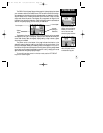
Let’s try panning around on the map display to see how that process works, and
then we’ll find a nearby airport, VOR, NDB or intersection and navigate to it. First we
will need to select an appropriate map scale to begin our search.
Select a five nautical mile scale by pressing zoom IN or OUT repeatedly.
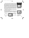
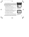
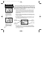
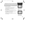
In the ‘Track Up’ orientation,
the map is automatically
rotated to keep your current
direction of travel at the top
of the screen. Note the north
indicator in upper-left corner.
Use the IN/OUT zoom keys
to change the map scale. The
current scale appears in the
lower-left corner of the map
display.
19
SIMULATOR TOUR
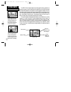
Using the Map Page
Background Cities,
Roads and Lakes
Present Position
Nearby Airport
Current Scale
Setting
GPS III Pilot B2 4/1/99 2:02 PM Page 19