


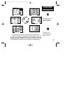
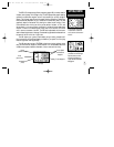
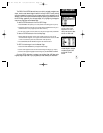
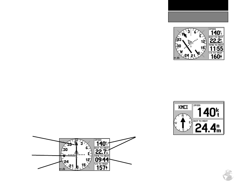
The GPS III Pilot features two different navigation pages: HSI (horizontal situation
indicator) and Highway. The HSI Page is first. The HSI Page provides graphic steering
guidance to a destination waypoint and will likely become your primary navigation
screen. (The Highway page also provides graphic steering guidance by displaying a
three-dimensional perspective of your course and the surrounding area.) The HSI
graphically depicts a mechanical HSI, showing the desired course using a ‘D-bar’
(course deviation bar; which is part of the course deviation indicator, or ‘CDI’) and
course pointer. If you move off course, the D-bar will indicate off course distance and
direction. To return to the desired course, simply steer in the direction of the D-bar
until it returns to the center of the CDI. The CDI scale is adjustable, with the current
scale indicated at the bottom of the page. The scale setting represents the distance from
the center of the CDI to full left or right limits.
The HSI depicts your (ground) track heading using a rotating ‘compass card’.
Don’t confuse this with the aircraft heading indicated on your panel. On a windy day
these two figures can differ significantly!
The HSI page also provides a TO/FROM indication and vertical guidance, when
using the unit’s vertical navigation (VNAV) features. Four user-selectable data fields
indicate current speed, distance to destination, time en route and time of day.
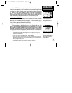
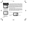
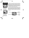
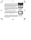
If you move off course, steer
in the direction of the D-bar
until it returns to the center of
the CDI.
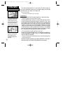
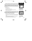
The ‘Big Numbers’ option
(available from the HSI Page
Options) shows a smaller
compass-type display and
larger data field characters.
See page 42.
11
GETTING STARTED
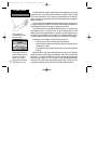
HSI Page
HSI Page
Compass Card
(Track)
Current Speed
and Distance to
Waypoint
Time to Waypoint
Pointer
(Desired Course)
D-bar
(part of CDI)
GPS III Pilot B2 4/1/99 2:02 PM Page 11