


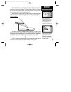
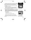
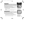

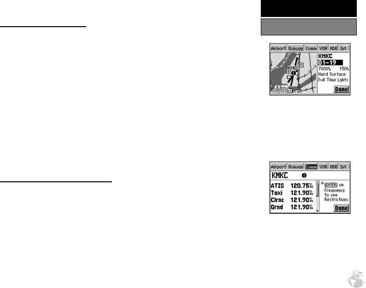
Runway Information Page
The Runway Information Page displays the identifier, designations, length, width,
surface type and lighting information for the selected airport. This page also provides
a graphic diagram of the runways and a map of the surrounding area. The surface type
information can be any one of: hard, turf, sealed, gravel, dirt, soft, unknown, or water.
The lighting information will indicate one of five lighting schemes: part time, full time,
pilot controlled (with frequency), no lighting or unknown.
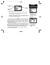
If the selected airport has more than one runway, additional runway data can be
viewed by selecting another runway from the runway designation field.
To view additional runway data:
1. Highlight the runway designation field and press ENTER. A list of the available runways
will appear.
2. Select the desired runway using the rocker keypad and press ENTER.
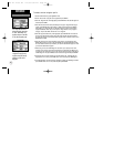
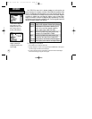
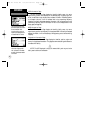
Communication Information Page
The Communication Information Page displays the identifier and radio frequen-
cies for the selected airport, along with any usage restrictions which may apply to a
given frequency. When a frequency type is followed by an ‘*’, that frequency will have
usage restrictions, typically based upon sector and/or altitude.
To view usage restrictions for a communication frequency:
1. Highlight the desired frequency (one with a type that’s followed by ‘*’) and press
ENTER. An information page will appear with additional data about the frequency.
2. Press QUIT to return to the Communication Information Page.
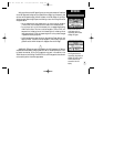
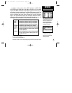
The Runway Information
Page allows you to view the
runways and the surrounding
area. Select the runway desig-
nation field to view data for
additional runways.
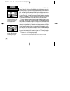
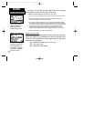
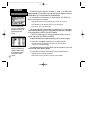
The Airport Communication
Information Page shows the
radio frequencies for the
selected airport. Any frequen-
cies with restrictions are
denoted by an asterisk (‘*’)
after the frequency type.
51
REFERENCE
Waypoint Information Pages
GPS III Pilot B2 4/1/99 2:02 PM Page 51