


45
Appendix D
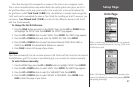
What Grid Formats does the eTrex
Support?
hddd.ddddd
o
(degrees, decimal degrees)
hddd
o
mm.mm
hddd
o
mm’ss.s
British Grid
Dutch Grid
Finnish KKJ27 Grid
German Grid
Irish Grid
Maidenhead
MGRS (Military Grid Reference System)
New Zealand
Qatar Grid
Swedish Grid
Swiss Grid
Taiwan Grid
UTM/UPS Grid
W Mayalan R
User Grid
FAQs
Why won’t the eTrex power on?
Check to see if the batteries are installed correctly and that the battery terminals are clean.
Can I use the eTrex indoors?
Not for navigation, but you can edit existing waypoints and routes, and you can use the Demo
mode to practice (see page 40).
Do I need to subscribe to a service to use the eTrex?
No. The GPS satellites are owned by the United States Department of Defense (DoD) and have
been funded by U.S. taxpayers’ dollars. Reception of GPS satellite signals is free to everyone.
Does the eTrex work anywhere in the world and in any weather?
Yes.
How accurate is a Garmin GPS?
The eTrex is accurate to within 15 meters. Using differential techniques (WAAS), the eTrex can
be as accurate as 1-5 meters.
Why can’t I see the display in the daylight?
Adjust the contrast (see page 1).
Why can’t I interface my computer with the eTrex?
Make sure that you have the correct INPUT/OUTPUT format selected on your eTrex.
What does the message "NO DGPS POSITION" mean?
eTrex had a differential fix and lost it.
What do I do if it takes more than 10 minutes to get a location fix?
There may be large obstacles overhead. Move to a new location with a clear view of the sky.
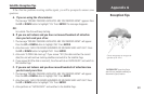
See “Satellite Reception Tips” on page 51.
Why don’t the eTrex coordinates match the location on my map?
Make sure the eTrex is configured to use the same datum as your map. See pages 35–37.