


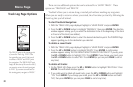

38
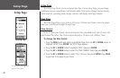
Angle
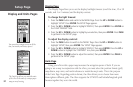
You can set the eTrex to display directional information in ‘DEGREES’ or in ‘MILS’.
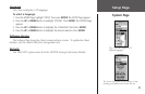
To select an Angle setting:
1. From the MENU Page, press the UP or DOWN button to highlight ‘SETUP.’ Press ENTER.
2. Press the
UP or DOWN button to select ‘UNITS.’ Press ENTER. The UNITS Page appears.
3. Press the
UP or DOWN button to select the ‘ANGLE’ field. Press ENTER.
4. Press the
UP or DOWN button to select ‘DEGREES’ or ‘MILS.’ Press ENTER. Press PAGE
to select the page of your choice.
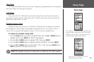
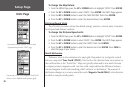
Defaults
You can restore the Units Page to the factory default settings by highlighting the
‘DEFAULTS’ field and pressing ENTER.
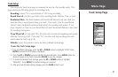
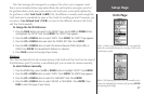
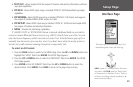
Interface Page
The Interface Page allows you to connect and use devices such as computers and differen-
tial GPS (DGPS) beacon receivers to the eTrex. Below is a description of the available formats.
Input/Output Formats
• GARMIN - the proprietary format used to exchange waypoint, route, and track data with
a PC.
• GARMIN DGPS - allows DGPS input using a Garmin beacon receiver and a standard
RTCM SC-104 format and DGPS tuning.
• NMEA OUT - supports the output of standard NMEA 0183 version 3.0 data.
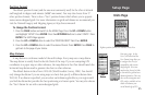
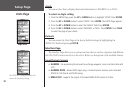
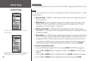
Setup Page
Units Page
Angle Units
The ‘DEFAULTS’ setting will reset the eTrex
units to all of its factory settings.