


36
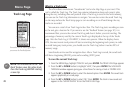
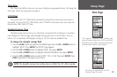
Setup Page
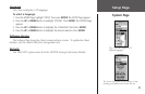
To change the Map Datum:
1. From the MENU Page, press the UP or DOWN button to highlight ‘SETUP.’ Press ENTER.
2. Press the
UP or DOWN button to select ‘UNITS.’ Press ENTER. The UNITS Page appears.
3. Press the
UP or DOWN button to select the ‘MAP DATUMS’ field. Press ENTER.
4. Press the
UP or DOWN button to select the desired datum. Press ENTER.
Distance/Speed Units
The eTrex lets you select statute (the default setting), nautical, or metric units of measure
for all speed and distance readouts.
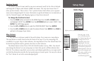
To change the Distance/Speed units:
1. From the MENU Page, press the UP or DOWN button to highlight ‘SETUP.’ Press ENTER.
2. Press the
UP or DOWN button to select ‘UNITS.’ Press ENTER. The UNITS Page appears.
3. Press the
UP or DOWN button to select the ‘UNITS’ field. Press ENTER.
4. Press the
UP or DOWN button to select the desired unit. Press ENTER. Press PAGE to
select the page of your choice.
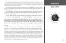
North Reference
‘Reference’ refers to the orientation of a map’s grid. Map makers try to align the vertical
lines on a map with ‘True North’ (TRUE). True North is the direction from any location on
the earth’s surface to the “North Pole.” Maps are typically referenced to true north. Because
a compass points to magnetic north, not true north, maps indicate the difference between
true and magnetic north with something called ‘variation’ or ‘declination.’ The amount of
declination changes as you move around the earth. Magnetic North (MAG) is the direction
in which a compass needle points.
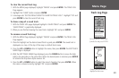
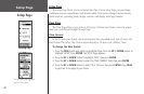
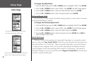
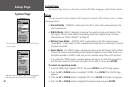
Units Page
You can select statute, nautical, or metric units
of measurement from the ‘UNITS’ page.
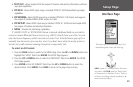
You can select True North, Magnetic North, Grid
North, or User-Defined north reference grids.