


NKClearNavManual•Version0.5•July3,2008
Page79of86
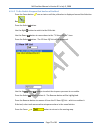
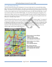
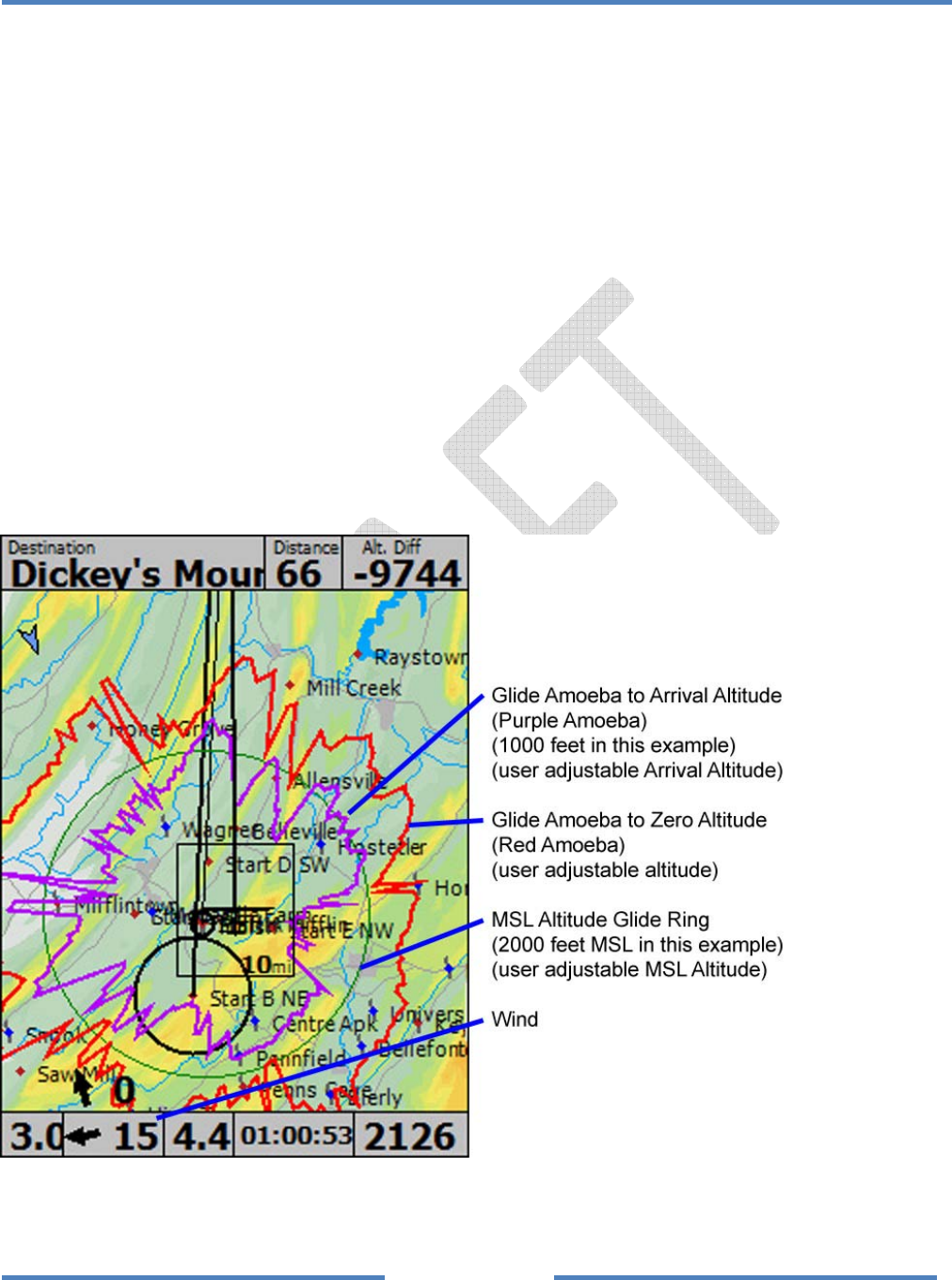
4.2.6 MSLAltitudeGlideRing
TheMSLAltitudeGlideRingcanbedisplayedonthemaptoshowhowfaryoucanglidedescending
downtotheuserselectedMSLAltitude.Thisoptionisaneatidea,butwearen’tsureyethowusefulit
willbe.Ifyoudon’tuseitwerecommendturningitofftolimittheamountofinformationonthemap.
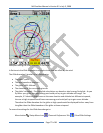
InstillairyoucanglidefromyourcurrentlocationallthewaytotheMSLAltitudeGlideRing.Youwill
arriveattheringattheuserselectedMSLAltitude.Theringwillonlydisplaywhenthegliderisatan
altitudethatishigherthantheuserselectedMSLAltitudeenteredfortheMSLAltitudeGlideRing.As
youincreasethenumberenteredintheMSLAltitudetheringwillgetclosertothegliderbecausethe
differenceinaltitudewillgetsmaller.
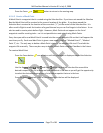
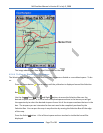
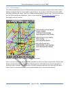
TheMSLAltitudeGlideRingmaybeusefuliswhentryingtooverflyanairspaceregion.Forexample,if
thereisairspacenearbythathasaceilingof3000feetMSL,youcouldsettheMSLAltitudeGlideRing
to3000feet(or3200feettobeconservative).Iftheairspaceyouwanttoflyoveriscompletelyinside
theMSLAltitudeGlideRingthenyouknowthatyoucanglideoverit.Iftheairspaceregionextends
beyondtheMSLAltitudeGlideRingthenyouknowthatyoucan’tmakeitallthewayacrossthe
airspaceregionwithoutdescendingdownintoit.