


NKClearNavManual•Version0.5•July3,2008
Page67of86
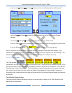
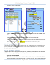
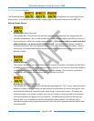
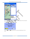
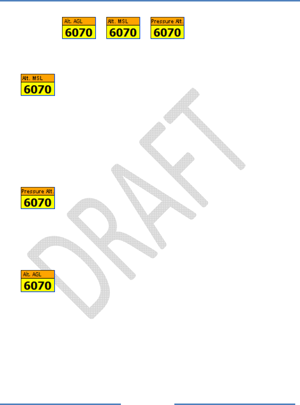
4.2.3.5 AltitudeWindow
TheAltitudeWindowororisdisplayedinthelowerrightcorner
ofthescreen.ItcandisplayseveralaltitudenumbersandcanbeusedtoaccesstheSetMSLTab.
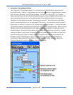
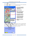
AltitudeDisplayOptions
•
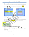
AltitudeMSL(MeanSeaLevel)
TheAltitudeMSListhealtitudethathasbeenadjustedtocompensateforchangesfromthe
standardatmosphere.YoucanandshouldedittheAltitudeMSLbeforetakeoffeverytimeyou
flybysettingittomatchtheknownairportelevation.Thisnumberistheoneusedforthefinal
glidecalculations–sobesuretosetitbeforetakeoff.TheAltitudeAGL(below)isbasedon
theMSLAltitudesoitwillonlydisplayaccuratelyiftheMSLAltitudeissetaccurately.Youcan
easilyusealocalautomatedweathertransmitter(AWOS)pressuresettingtoadjusttheMSL
Altitudeinflight.
•
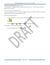
PressureAltitude
ThePressureAltitudeistherawaltitudefromthepressuretransducerandshowsthealtitudein
astandardatmosphere.Sincethelocalbarometricpressureisnotlikelytomatchthestandard
atmospherethisnumberwillbedifferentthantheMSLAltitude.Thisnumberisusedwhen
nearspecialuseairspacesuchaswhennear18,000feetintheUSA.
•
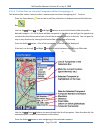
AltitudeAGL(AboveGroundLevel)
TheAltitudeAGListheapproximatealtitudeabovegroundlevel.Thisisaverypowerfulfeature
becauseitmakesiteasytoknowyourapproximatealtitudeabovetheterrainataglance.You
willfindtheAltitudeAGLespeciallyusefulwhenflyinginmountainousareas.Ofcourse,the
elevationmodelisnotperfect,sodon’tcountonthisnumbertowarnyouaboutlocalobjects
thatstandupabovethegeneralterrainelevation.TheMSLAltitudeisusedtocalculatethe
AltitudeAGLsoitis
importanttosettheAltitudeMSLbeforetakeoff.TheAltitudeAGLis
calculatedbysubtractingthegroundelevation(fromthebuilt‐ingroundelevationmodel)from
theAltitudeMSL.