


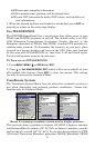
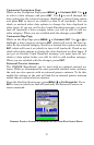
83
highlighted. Press
ENT to create the first point. After it is created, you
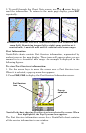
will be taken back to the Map Page. The message Scout 1 appears in
the lower right corner, indicating a scouting session is underway.
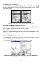
5. Repeat these steps for setting a point at every major corner of the
area you are scouting. The iFINDER will link the flag points and draw
the perimeter of the area you walked.
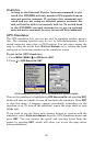
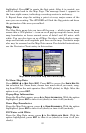
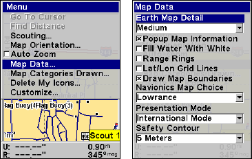
Map Data
The Map Data menu lets you turn off the map — which turns the map
screen into a GPS plotter — turn on or off pop-up map info boxes, draw
map boundaries or boxes around areas of detail and fill water with
white. You can also turn on or off Map Overlays, which display range
rings and latitude and longitude grid lines on the map. Navionics maps
also may be accessed on the Map Data menu. For detailed instructions,
see the Navionics Charts entry in this section.
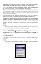
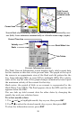
Map Menu (left) with Map Data Menu (right).
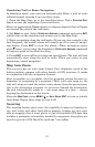
To Show Map Data
Press
MENU|↓ to MAP DATA|ENT. Press ENT to access the EARTH MAP DE-
TAIL
selection list. From there, choose how much detail you want, rang-
ing from Off (so the unit operates like a GPS plotter) to High. After the
option is set, press
EXIT.
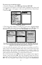
Popup Map Information
From the Map Data menu, press ↓ to
POPUP INFORMATION. With the option
highlighted, press
ENT to turn it on (check) or turn it off (uncheck).
Draw Map Boundaries
From the Map Data menu, press ↓ to
DRAW BOUNDARIES. With the option
highlighted, press
ENT to turn it on (check) or turn it off (uncheck).
Fill Water with White
From the Map Data menu, press ↓ to
FILL WATER WITH WHITE. With the
option highlighted, press
ENT to turn it on (check) or turn it off (un-
check).